Janesville, California
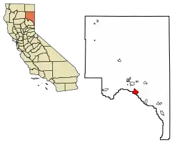
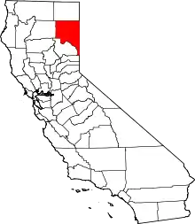
Janesville (also known as Lassen)[3] is a census-designated place[4] in Lassen County, California.[2] It is located 11 miles (18 km) southeast of Susanville,[3] at an elevation of 4239 feet (1292 m).[2] Janesville is located on the eastern slopes of the Sierra Nevada Mountain range. Its population is 2,461 as of the 2020 census, up from 1,408 from the 2010 census.
Janesville | |
|---|---|
 Location of Janesville in Lassen County, California. | |
 Janesville Location in California | |
| Coordinates: 40°17′48″N 120°31′27″W | |
| Country | |
| State | |
| County | Lassen County |
| Area | |
| • Total | 13.199 sq mi (34.186 km2) |
| • Land | 13.187 sq mi (34.154 km2) |
| • Water | 0.012 sq mi (0.032 km2) 0.09% |
| Elevation | 4,239 ft (1,292 m) |
| Population (2020) | |
| • Total | 2,461 |
| • Density | 190/sq mi (72/km2) |
| Time zone | UTC-8 (Pacific (PST)) |
| • Summer (DST) | UTC-7 (PDT) |
| ZIP Code | 96114 |
| Area code | 530 |
| GNIS feature IDs | 1658853; 2611437 |
| U.S. Geological Survey Geographic Names Information System: Janesville, California; U.S. Geological Survey Geographic Names Information System: Janesville, California | |
The community consists of an elementary school, a park, four churches, two gas stations, a pizza parlor, a coffee shop, a veterinary hospital, a hardware store, a post office, and a few other businesses.
Janesville stretches over a distance of 8 miles (13 km). Its ZIP Code is 96114. The community is inside area code 530.
History
Fort Janesville In 1860, after the First Battle of Pyramid Lake, part of the Paiute War, and the Ormsby Massacre, settlers built a loopholed stockade for protection from an Indian attack that never materialized. The fort, which had a bastion, or block house, in its southwest corner, was located less than a mile from the town of Janesville. The site of the fort is now a California Historic Landmark No.758.[5][6]
In 1864, Janesville lost to Susanville by one vote from becoming the county seat. The Janesville post office opened in 1861, closed for a time in 1864, changed its name to Lassen in 1914, and renamed to Janesville in 1923. The name honors Jane Bankhead, wife of an early settler.[3]
Geography
According to the United States Census Bureau, the CDP has a total area of 13.2 square miles (34.2 km2), of which over 99% is land.
Demographics
| Census | Pop. | Note | %± |
|---|---|---|---|
| U.S. Decennial Census[7] | |||
The 2010 United States Census[8] reported that Janesville had a population of 1,408. The population density was 106.7 inhabitants per square mile (41.2/km2). The racial makeup of Janesville was 1,283 (91.1%) White, 13 (0.9%) African American, 32 (2.3%) Native American, 11 (0.8%) Asian, 3 (0.2%) Pacific Islander, 27 (1.9%) from other races, and 39 (2.8%) from two or more races. Hispanic or Latino of any race were 118 persons (8.4%).
The Census reported that 1,400 people (99.4% of the population) lived in households, 8 (0.6%) lived in non-institutionalized group quarters, and 0 (0%) were institutionalized.
There were 535 households, out of which 166 (31.0%) had children under the age of 18 living in them, 361 (67.5%) were opposite-sex married couples living together, 32 (6.0%) had a female householder with no husband present, 22 (4.1%) had a male householder with no wife present. There were 19 (3.6%) unmarried opposite-sex partnerships, and 6 (1.1%) same-sex married couples or partnerships. 96 households (17.9%) were made up of individuals, and 31 (5.8%) had someone living alone who was 65 years of age or older. The average household size was 2.62. There were 415 families (77.6% of all households); the average family size was 2.96.
The population was spread out, with 344 people (24.4%) under the age of 18, 69 people (4.9%) aged 18 to 24, 291 people (20.7%) aged 25 to 44, 508 people (36.1%) aged 45 to 64, and 196 people (13.9%) who were 65 years of age or older. The median age was 45.0 years. For every 100 females, there were 106.1 males. For every 100 females age 18 and over, there were 104.6 males.
There were 615 housing units at an average density of 46.6 per square mile (18.0/km2), of which 460 (86.0%) were owner-occupied, and 75 (14.0%) were occupied by renters. The homeowner vacancy rate was 2.5%; the rental vacancy rate was 9.6%. 1,206 people (85.7% of the population) lived in owner-occupied housing units and 194 people (13.8%) lived in rental housing units.
Politics
In the state legislature, Janesville is in the 1st Senate District, represented by Republican Brian Dahle,[9] and the 1st Assembly District, represented by Republican Megan Dahle.[10]
Federally, Janesville is in California's 1st congressional district, represented by Republican Doug LaMalfa.[11]
References
- "U.S. Census". Archived from the original on July 2, 2012.
- U.S. Geological Survey Geographic Names Information System: Janesville, California
- Durham, David L. (1998). California's Geographic Names: A Gazetteer of Historic and Modern Names of the State. Clovis, Calif.: Word Dancer Press. p. 388. ISBN 1-884995-14-4.
- U.S. Geological Survey Geographic Names Information System: Janesville, California
- "Fort Janesville #758". Office of Historic Preservation, California State Parks. Retrieved October 7, 2012.
- "From the Files of the Lassen Historical Society: The Short History of Fort Janesville". March 31, 2022.
- "Census of Population and Housing". Census.gov. Retrieved June 4, 2016.
- "2010 Census Interactive Population Search: CA - Janesville CDP". U.S. Census Bureau. Archived from the original on July 15, 2014. Retrieved July 12, 2014.
- "Senators". State of California. Retrieved March 10, 2013.
- "Members Assembly". State of California. Retrieved March 2, 2013.
- "California's 1st Congressional District - Representatives & District Map". Civic Impulse, LLC. Retrieved March 3, 2013.
