Jama, Dumka (village)
Jama is a village in the Jama community development block in the Dumka Sadar subdivision of the Dumka district in the Indian state of Jharkhand.
Jama | |
|---|---|
Village | |
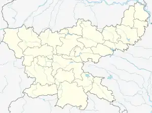
 Jama Location in Jharkhand, India  Jama Jama (India) | |
| Coordinates: 24.368333°N 87.264444°E | |
| Country | |
| State | Jharkhand |
| District | Dumka |
| Population (2011) | |
| • Total | 843 |
| Languages (*For language details see Jama, Dumka#Language and religion) | |
| • Official | Hindi, Urdu |
| Time zone | UTC+5:30 (IST) |
| PIN | 814110 |
| Telephone/ STD code | 06431 |
| Lok Sabha constituency | Dumka |
| Vidhan Sabha constituency | Jama |
| Website | dumka |
Geography
M: Municipality, CT: census town, R: Rural/ Urban centre, D: Dam,
Owing to space constraints in the small map, the actual locations in a larger map may vary slightly
Location
Jama is located at 24.368333°N 87.264444°E.
Overview
The map shows a large area, which is a plateau with low hills, except in the eastern portion where the Rajmahal hills intrude into this area and the Ramgarh hills are there. The south-western portion is just a rolling upland. The entire area is overwhelmingly rural with only small pockets of urbanisation.[1]
Note: The full screen map is interesting. All places marked on the map are linked in the full screen map and one can easily move on to another page of his/her choice. Enlarge the full screen map to see what else is there – one gets railway connections, many more road connections and so on.
Area
Jama has an area of 161 hectares (400 acres).[2]
Demographics
According to the 2011 Census of India, Jama had a total population of 843, of which 413 (49%) were males and 430 (51%) were females. Population in the age range 0–6 years was 143. The total number of literate persons in Jama was 700 (67.00% of the population over 6 years).[2]
Civic administration
Police station
There is a police station at Jama.[3]
CD block HQ
Headquarters of Jama, Dumka CD block is at Jama village.[4]
Education
Kasturba Gandhi Balika Vidyalaya, Jama, is a Hindi-medium girls only institution established in 2007. It has facilities for teaching from class VI to class XII.[5]
Government High School Jama at Jarpura is a Hindi-medium coeducational institution established in 1969. It has facilities for teaching from class IX to class XII.[6]
References
- Roychoudhury, P.C. "Bihar District Gazetteers: Santhal Parganas". Chapter I: General. Secretariat Press, Patna, 1965. Retrieved 10 November 2020.
- "District Census Handbook, Dumka, Series 21, Part XII B" (PDF). Page 25: District Primary Census Abstract, 2011 census. Directorate of Census Operations Jharkhand. Retrieved 6 November 2020.
- "District Police Profile - Dumka". Jharkhand Police. Retrieved 6 November 2020.
- "District Census Handbook, Dumka, Series 21, Part XII B" (PDF). Map of Dumka on the third page. Directorate of Census Operations Jharkhand. Retrieved 6 November 2020.
- "KGBV Jama". Schools.org. Retrieved 6 November 2020.
- "High School Jama". Schools.org.in. Retrieved 5 November 2020.
