Jagmohanpur
Jagmohanpur is a village in Chanditala I community development block of Srirampore subdivision in Hooghly district in the Indian state of West Bengal.[1]
Jagmohanpur | |
|---|---|
Village | |
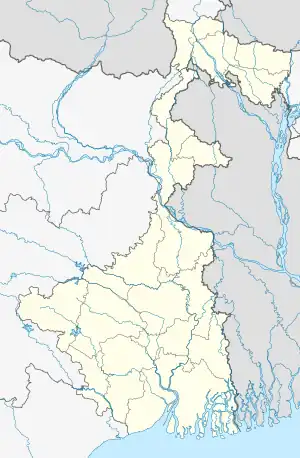 Jagmohanpur Location in West Bengal, India  Jagmohanpur Jagmohanpur (India) | |
| Coordinates: 22.7130798°N 88.163115°E | |
| Country | |
| State | West Bengal |
| District | Hooghly |
| Government | |
| • Body | Gram panchayat |
| Population (2011) | |
| • Total | 1,193 |
| Languages | |
| • Official | Bengali, English |
| Time zone | UTC+5:30 (IST) |
| PIN | 712701 |
| ISO 3166 code | IN-WB |
| Vehicle registration | WB |
| Lok Sabha constituency | Serampore |
| Vidhan Sabha constituency | Chanditala |
| Website | wb |
Geography
Jagmohanpur is located at 22.7130798°N 88.163115°E.[2]
Gram panchayat
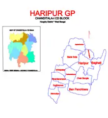
Villages in Haripur gram panchayat are: Anantarampur, Bade Sola, Baghati, Ban Panchbere, Chak Bangla, Chota Choughara, Dudhkomra, Haripur, Ichhapasar, Jagmohanpur, Mamudpur and Radhaballabhpur.[3]
Demographics
As per 2011 Census of India Jagmohanpur had a total population of 1,193 of which 600 (50%) were males and 593 (50%) were females. Population below 6 years was 105. The total number of literates in Jagmohanpur was 944 (86.76% of the population over 6 years).[4]
Transport
Bara Choughara Street links it to Munsirhat-Mosat Road. Bargachia railway station and Baruipara railway station are the nearest railway stations.[5]
Culture
Jatiya Sadharan Pathagar at Jagmohanpur was established in 1961.[6]
References
- "banglarbhumi.gov.in". WEST BENGAL ->HUGLI(হুগলী) ->CHANDITALA-I (চণ্ডীতলা-১) Mouza Information. Government of West Bengal. Archived from the original on 22 December 2016. Retrieved 6 October 2018.
- "Census of India 2011, West Bengal: District Census Handbook, Hooghly" (PDF). Map of Chanditala I CD Block, page 649, Jagmohanpur Village 609. Directorate of Census Operations, West Bengal. Retrieved 6 October 2018.
- "Haripur". Indian Village Directory. Retrieved 12 October 2018.
- "C.D. Block Wise Primary Census Abstract Data(PCA)". 2011 census: West Bengal – District-wise CD Blocks. Registrar General and Census Commissioner, India. Retrieved 7 October 2018.
- Google maps
- "List of Government-sponsored Libraries in the district of Hooghly" (PDF). Serial No. 71. Government of West Bengal. Retrieved 6 October 2018.
Cities, towns and locations in Hooghly district | |||||||||
|---|---|---|---|---|---|---|---|---|---|
| Cities, municipalities and census towns |
| ||||||||
| Locations other than cities and towns |
| ||||||||
| Neighbourhoods | |||||||||
| Related topics |
| ||||||||