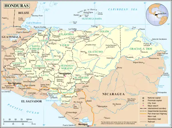
List of islands of Honduras
This is a list of islands of Honduras. There are at least 99 islands in Honduras.[1]
The Honduras
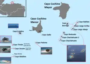
Cayos Cochinos
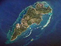
Guanaja
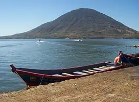
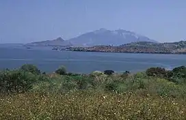
Isla del Tigre
Isla Zacate Grande
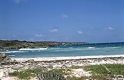
Little Swan Island
Islands
The following islands are part of Honduras:[1]
- Caribbean islands (all part of Islas de la Bahía Department)
- Bobel Cay, 15°05′00″N 82°40′00″W
- Cayos Cochinos (Islas de la Bahía), 15°58′00″N 86°28′00″W
- Cayo Cochino Grande (Mayor), 15°59′13″N 86°28′39″W[2]
- Cayo Cochino Menor, 15°57′30″N 86°30′05″W[2]
- Cayo Culebra, 15°57′14″N 86°31′10″W[2]
- Cayo Gallo
- Cayo Timon
- Cayo Zacate
- Cayo Arena, 15°57′N 86°33′W
- Cayo Bolanos
- Cayo Paloma (nature preserve), 15°56′45″N 86°30′14″W[2]
- Cayo Borrego
- Cayo Balfate
- Cayo Largo Arriba
- Cayo Redondo, 15°58′00″N 86°30′00″W
- Cayo Chachahaute 2
- Cayo Chachahaute, 15°57′06″N 86°28′39″W[2]
- Islas de la Bahía, 16°20′00″N 86°30′00″W
- Guanaja (Islas de la Bahía), 16°30′00″N 85°55′00″W
- Roatán (Islas de la Bahía) (Isla Roatan), 16°22′20″N 86°25′41″W
- Barbareta (Islas de la Bahía Department), 16°24′00″N 86°08′00″W
- Utila (Islas de la Bahía), 16°06′00″N 86°56′00″W
- Savanna Cay, 15°08′00″N 82°34′50″W
- Cayo Sur, 15°04′00″N 82°30′00″W
- Swan Islands
- Isla Grande, 17°24′32″N 83°55′57″W
- Little Swan Island (Isla Pequeña), 17°24′43″N 83°53′56″W
- Cayo Gorda, 15°51′30″N 82°24′00″W
- Isla Zacate Grande, 13°20′19″N 87°37′41″W
- Pacific islands (part of Valle department)
- Isla del Tigre, 13°15′56″N 87°38′16″W
- Isla Conejo (disputed island, El Salvador), 13°20′52″N 87°44′34″W
See also
References
- "Islands of the Honduras". GeoNames. Retrieved September 28, 2021.
- Google maps

This article is issued from Wikipedia. The text is licensed under Creative Commons - Attribution - Sharealike. Additional terms may apply for the media files.