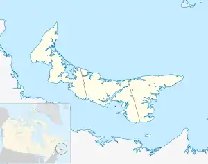
Hunter River, Prince Edward Island
Hunter River is a municipality that holds community status in Prince Edward Island, Canada.[1] It is located in Queens County southwest of North Rustico. It is situated on the Hunter River.
Hunter River | |
|---|---|
 Hunter River in Prince Edward Island | |
| Coordinates: 46.35497°N 63.34897°W | |
| Country | Canada |
| Province | Prince Edward Island |
| County | Queens County |
| Parish | Grenville Parish |
| Township | Lot 23 |
| Incorporated | 1974 |
| Community | 1983 |
| Government | |
| • CAO | Sarah Weeks |
| Area | |
| • Total | 2.33 sq mi (6.04 km2) |
| Population (2021) | |
| • Total | 390 |
| • Density | 167/sq mi (64.5/km2) |
| Time zone | UTC-4 (AST) |
| • Summer (DST) | UTC-3 (ADT) |
| Canadian Postal code | |
| Area code | 902 |
| Telephone Exchanges | 621, 734, 964 |
| NTS Map | 011L06 |
| GNBC Code | BAEKC |
| Website | Community Website |
It has been suggested that Hunter River is represented in the works of Lucy Maud Montgomery as Bright River in the fictional region of Avonlea.[2]
James Charles McGuigan, who became Archbishop of Toronto and a Cardinal, was born in Hunter River.
Demographics
In the 2021 Census of Population conducted by Statistics Canada, Hunter River had a population of 390 living in 164 of its 170 total private dwellings, a change of 9.6% from its 2016 population of 356. With a land area of 6.04 km2 (2.33 sq mi), it had a population density of 64.6/km2 (167.2/sq mi) in 2021.[12]
References
- "Municipal Councils and Contact Information" (PDF). Government of Prince Edward Island. January 27, 2017. Archived from the original (PDF) on December 29, 2016. Retrieved February 4, 2017.
- Notes on the Geography and Chronology of the Anne of Green Gables Books
- "1976 Census of Canada: Population - Geographic Distributions" (PDF). Statistics Canada. June 1977. Retrieved February 2, 2022.
- "1981 Census of Canada: Census subdivisions in decreasing population order" (PDF). Statistics Canada. May 1992. Retrieved February 2, 2021.
- "1986 Census: Population - Census Divisions and Census Subdivisions" (PDF). Statistics Canada. September 1987. Retrieved February 2, 2022.
- "91 Census: Census Divisions and Census Subdivisions - Population and Dwelling Counts" (PDF). Statistics Canada. April 1992. Retrieved February 2, 2022.
- "96 Census: A National Overview - Population and Dwelling Counts" (PDF). Statistics Canada. April 1997. Retrieved February 2, 2022.
- "Population and Dwelling Counts, for Canada, Provinces and Territories, and Census Subdivisions (Municipalities), 2001 and 1996 Censuses - 100% Data (Prince Edward Island)". Statistics Canada. August 15, 2012. Retrieved February 2, 2022.
- "Population and dwelling counts, for Canada, provinces and territories, and census subdivisions (municipalities), 2006 and 2001 censuses - 100% data (Prince Edward Island)". Statistics Canada. August 20, 2021. Retrieved February 2, 2022.
- "Population and dwelling counts, for Canada, provinces and territories, and census subdivisions (municipalities), 2011 and 2006 censuses (Prince Edward Island)". Statistics Canada. July 25, 2021. Retrieved February 2, 2022.
- "Population and dwelling counts, for Canada, provinces and territories, and census subdivisions (municipalities), 2016 and 2011 censuses – 100% data (Prince Edward Island)". Statistics Canada. February 8, 2017. Retrieved February 2, 2022.
- "Population and dwelling counts: Canada, provinces and territories, and census subdivisions (municipalities), Prince Edward Island". Statistics Canada. February 9, 2022. Retrieved March 3, 2022.
This article is issued from Wikipedia. The text is licensed under Creative Commons - Attribution - Sharealike. Additional terms may apply for the media files.