Hrazany
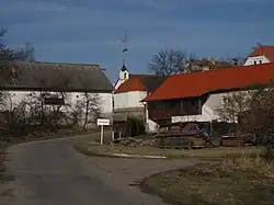
Hrazany is a municipality and village in Písek District in the South Bohemian Region of the Czech Republic. It has about 300 inhabitants.
Hrazany | |
|---|---|
 Dobrošov, a part of Hrazany | |
 Flag  Coat of arms | |
 Hrazany Location in the Czech Republic | |
| Coordinates: 49°31′22″N 14°20′6″E | |
| Country | |
| Region | South Bohemian |
| District | Písek |
| First mentioned | 1373 |
| Area | |
| • Total | 8.49 km2 (3.28 sq mi) |
| Elevation | 535 m (1,755 ft) |
| Population (2023-01-01)[1] | |
| • Total | 289 |
| • Density | 34/km2 (88/sq mi) |
| Time zone | UTC+1 (CET) |
| • Summer (DST) | UTC+2 (CEST) |
| Postal code | 399 01 |
| Website | www |
Administrative parts
Villages of Dobrošov, Hrazánky and Klisinec are administrative parts of Hrazany.
Etymology
The name of the village has no clear origin, it was derived from the Czech word hráz (i.e. "dyke") or hrad (i.e. "castle").[2]
Geography

Hrazany is located about 27 kilometres (17 mi) northeast of Písek and 54 km (34 mi) south of Prague. It lies in the Vlašim Uplands. The highest point is at 582 metres (1,909 ft) above sea level.
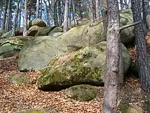
Near the village of Hrazany there is the Kněz u Hrazan Nature Monument. It is a blockfield, a remnant of the glacial age.[3]
History
The first written mention of Hrazany and Hrazánky is from 1373. The village of Dobrošov was first mentioned in 1216.[4]
Sights
Almost no original buildings have been preserved. The only monuments are the chapels. The oldest one is the Chapel of Sain John of Nepomuk in Hrazánky from the 19th century. The Chapel of the Holy Spirit in Hrazany dates from 1926 and the Chapel of Saint Wenceslaus in Dobrošov dates from 1932.[4]
References
- "Population of Municipalities – 1 January 2023". Czech Statistical Office. 2023-05-23.
- Profous, Antonín (1947). Místní jména v Čechách I: A–H (in Czech). p. 765.
- "Kněz u Hrazan" (in Czech). Milevskem.cz. Retrieved 2022-08-31.
- "Historie" (in Czech). Obec Hrazany. Retrieved 2022-08-31.