Howdendyke
Howdendyke is a hamlet in the East Riding of Yorkshire, England. It is situated approximately 2 miles (3.2 km) north of Goole town centre and about 1 mile (1.6 km) south of Howden.
.jpg.webp)
MV Cedar alongside the jetties at Howdendyke
| Howdendyke | |
|---|---|
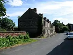 Howdendyke Main street | |
 Howdendyke Location within the East Riding of Yorkshire | |
| OS grid reference | SE754269 |
| • London | 155 mi (249 km) S |
| Civil parish | |
| Unitary authority | |
| Ceremonial county | |
| Region | |
| Country | England |
| Sovereign state | United Kingdom |
| Post town | GOOLE |
| Postcode district | DN14 |
| Dialling code | 01430 |
| Police | Humberside |
| Fire | Humberside |
| Ambulance | Yorkshire |
| UK Parliament | |
Howdendyke forms part of the civil parish of Kilpin.
It lies on the north bank of the River Ouse and has port facilities run by PD Ports.[1]
References
- "Howden". PD Ports. Retrieved 19 May 2020.
- Gazetteer — A–Z of Towns Villages and Hamlets. East Riding of Yorkshire Council. 2006. p. 7.
- Porteous, John Douglas (1989). Planned to death: the annihilation of a place called Howdendyke. Manchester University Press ND. ISBN 0-7190-2831-0.
Wikimedia Commons has media related to Howdendyke.
| Unitary authorities | |
|---|---|
| Major settlements (cities in italics) | |
| Rivers | |
| Canals | |
| Topics | |
This article is issued from Wikipedia. The text is licensed under Creative Commons - Attribution - Sharealike. Additional terms may apply for the media files.