Hopsten
Hopsten is a municipality in the district of Steinfurt, in North Rhine-Westphalia, Germany. It is situated approximately 15 km northeast of Rheine and 25 km southeast of Lingen.
Hopsten | |
|---|---|
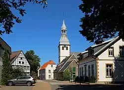 Historical center of the town | |
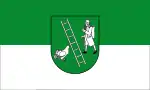 Flag  Coat of arms | |
Location of Hopsten within Steinfurt district 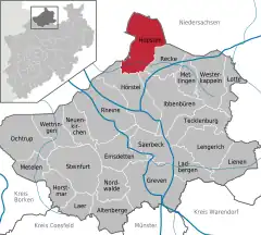 | |
 Hopsten 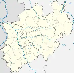 Hopsten | |
| Coordinates: 52°22′50″N 7°36′00″E | |
| Country | Germany |
| State | North Rhine-Westphalia |
| Admin. region | Münster |
| District | Steinfurt |
| Subdivisions | 3 |
| Government | |
| • Mayor (2020–25) | Ludger Kleine-Harmeyer[1] (CDU) |
| Area | |
| • Total | 99.8 km2 (38.5 sq mi) |
| Elevation | 40 m (130 ft) |
| Population (2021-12-31)[2] | |
| • Total | 7,704 |
| • Density | 77/km2 (200/sq mi) |
| Time zone | UTC+01:00 (CET) |
| • Summer (DST) | UTC+02:00 (CEST) |
| Postal codes | 48496 |
| Dialling codes | 05458 |
| Vehicle registration | ST |
| Website | www.hopsten.de |
People
- Bernhard Otte (1883-1933), politician and trade union leader
- Franz-Josef Kemper (born 1945), athlete
Gallery
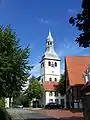 Catholic Church
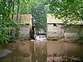 Mill Halverde
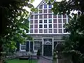 Haus Nieland
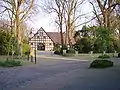 Hof Holling on the Brennikmeyer Street
References
- Wahlergebnisse in NRW Kommunalwahlen 2020, Land Nordrhein-Westfalen, accessed 30 June 2021.
- "Bevölkerung der Gemeinden Nordrhein-Westfalens am 31. Dezember 2021" (in German). Landesbetrieb Information und Technik NRW. Retrieved 20 June 2022.
Wikimedia Commons has media related to Hopsten.
Towns and municipalities in Steinfurt (district) | ||
|---|---|---|
Coat of Arms of Steinfurt district | ||
This article is issued from Wikipedia. The text is licensed under Creative Commons - Attribution - Sharealike. Additional terms may apply for the media files.