Hoenkoop
Hoenkoop is a hamlet in the Dutch province of Utrecht.
Hoenkoop | |
|---|---|
Village | |
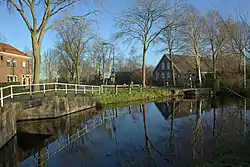 Street view | |
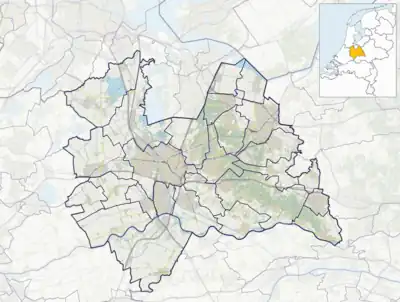 Hoenkoop Location in the Netherlands  Hoenkoop Hoenkoop (Netherlands) | |
| Coordinates: 52.00349°N 4.84747°E | |
| Country | Netherlands |
| Province | Utrecht |
| Municipality | Oudewater |
| Area | |
| • Total | 0.09 km2 (0.03 sq mi) |
| Population (2021)[1] | |
| • Total | 455 |
| • Density | 5,100/km2 (13,000/sq mi) |
| Time zone | UTC+1 (CET) |
| • Summer (DST) | UTC+2 (CEST) |
| Postal code | 3421[1] |
| Dialing code | 0348 |
Since 1970, Hoenkoop has been a part of the municipality of Oudewater. Between 1815 and 1970, it was a separate municipality.[2]
The hamlet was first mentioned in 1299 or 1300 Hoencoop, and means "(peat) concession", however the name first name Hoen does not fit.[3] Hoenkoop has not place name signs. In 1840, it was home to 324 people.[2]
Gallery
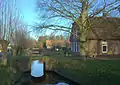 Farms in Hoenkoop
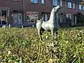 Horse statue by Piet van Heerden
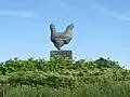 Chicken statue
References
- "Kerncijfers wijken en buurten 2021". Central Bureau of Statistics. Retrieved 27 March 2022.
- "Hoenkoop". Plaatsengids (in Dutch). Retrieved 27 March 2022.
- "Hoenkoop - (geografische naam)". Etymologiebank (in Dutch). Retrieved 27 March 2022.
Wikimedia Commons has media related to Hoenkoop.
This article is issued from Wikipedia. The text is licensed under Creative Commons - Attribution - Sharealike. Additional terms may apply for the media files.