Herpt
Herpt is a village in the municipality of Heusden in the Dutch province of North Brabant, about one kilometre southeast of the city center.
Herpt | |
|---|---|
Village | |
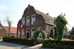 Farm in Herpt | |
 Coat of arms | |
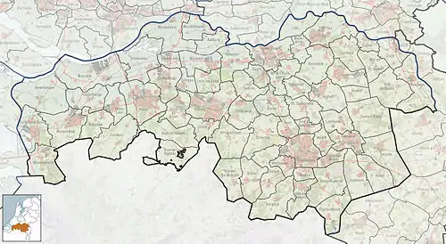 Herpt Location in the province of North Brabant in the Netherlands  Herpt Herpt (Netherlands) | |
| Coordinates: 51°44′0″N 5°9′0″E | |
| Country | Netherlands |
| Province | North Brabant |
| Municipality | Heusden |
| Area | |
| • Total | 5.44 km2 (2.10 sq mi) |
| Population (2021)[1] | |
| • Total | 760 |
| • Density | 140/km2 (360/sq mi) |
| Time zone | UTC+1 (CET) |
| • Summer (DST) | UTC+2 (CEST) |
| Postal code | 5255[1] |
| Dialing code | 0416 |
History
The village was first mentioned between 1108 and 1121 Harpede. The etymology is unclear.[2]
The Dutch Reformed church dated from the 15th century, but was destroyed on 5 November 1944 by the Germans and not rebuilt. The Catholic church dates from 1924.[3]
Herpt was home to 380 people in 1840.[3] Herpt was a separate municipality until 1935 (sometimes called Herpt en Bern or Herpt c.a.), when it became a part of Heusden.[4]
Gallery
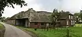 Farm in Herpt
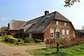 Farm in Herpt
References
- "Kerncijfers wijken en buurten 2021". Central Bureau of Statistics. Retrieved 16 April 2022.
- "Herpt - (geografische naam)". Etymologiebank (in Dutch). Retrieved 16 April 2022.
- "Herpt". Plaatsengids (in Dutch). Retrieved 16 April 2022.
- Ad van der Meer and Onno Boonstra, Repertorium van Nederlandse gemeenten, KNAW, 2011.
Wikimedia Commons has media related to Herpt.
This article is issued from Wikipedia. The text is licensed under Creative Commons - Attribution - Sharealike. Additional terms may apply for the media files.