Hermel District
The Hermel District (Arabic: قضاء الهرمل) is a district in the Baalbek-Hermel Governorate of Lebanon. Its population is estimated at 48,000 inhabitants, with its semi-arid land contributing to its low population density. It borders the Akkar District and Miniyeh-Danniyeh District on its west, the Baalbek District in the south and east, and Syria on its north.[1]
Hermel District | |
|---|---|
District | |
| قضاء الهرمل' | |
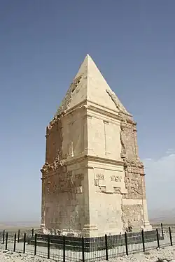
 Hermel Pyramid | |
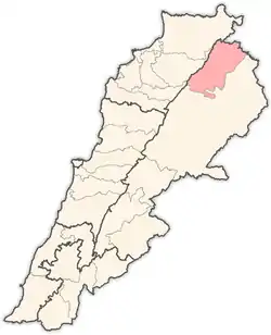
 Location in Lebanon | |
| Country | |
| Governorate | Baalbek-Hermel Governorate |
| Capital | Hermel |
| Area | |
| • Total | 282 sq mi (731 km2) |
| Population | |
| • Total | 48,000 |
| • Density | 170/sq mi (66/km2) |
| Time zone | UTC+2 (EET) |
| • Summer (DST) | UTC+3 (EEST) |
Hermel descends from the highest peak in Lebanon, Qorna al-Souda, at an altitude of 3080 meters.
It is bordered by Akkar and Dannieh districts to the west, Baalbek district to the south and east, and the border with Syria to the north.
The capital of the Hermel District is Hermel.
On January 3, 2021, an explosion at a fuel storage facility in the town of Al-Qasr injured 10.[2]
References
- "Hermel District - Localiban". www.localiban.org. Retrieved 2016-07-18.
- "10 injured in fuel warehouse explosion in Lebanon's Bekaa district - Xinhua | English.news.cn". www.xinhuanet.com. Archived from the original on 2021-01-03.
This article is issued from Wikipedia. The text is licensed under Creative Commons - Attribution - Sharealike. Additional terms may apply for the media files.