Hannawa Falls, New York
Hannawa Falls is a hamlet and census-designated place in St. Lawrence County, New York, United States. Its population was 1,042 as of the 2010 census.[1] Hannawa Falls has a post office with ZIP code 13647.[3][4] New York State Route 56 passes through the community.
Hannawa Falls, New York | |
|---|---|
 Hannawa Falls, New York  Hannawa Falls, New York | |
| Coordinates: 44°36′44″N 74°58′16″W | |
| Country | United States |
| State | New York |
| County | St. Lawrence |
| Area | |
| • Total | 5.412 sq mi (14.02 km2) |
| • Land | 5.110 sq mi (13.23 km2) |
| • Water | 0.302 sq mi (0.78 km2) |
| Elevation | 558 ft (170 m) |
| Population | |
| • Total | 1,042 |
| • Density | 190/sq mi (74/km2) |
| Time zone | UTC-5 (Eastern (EST)) |
| • Summer (DST) | UTC-4 (EDT) |
| ZIP code | 13647 |
| Area code(s) | 315 & 680 |
| GNIS feature ID | 976407[2] |
Geography
According to the U.S. Census Bureau, the community has an area of 5.412 square miles (14.02 km2); 5.110 square miles (13.23 km2) of its area is land, and 0.302 square miles (0.78 km2) is water.[1]
References
- "2010 Census Gazetteer Files - Places: New York". U.S. Census Bureau. Retrieved April 6, 2017.
- "Hannawa Falls". Geographic Names Information System. United States Geological Survey, United States Department of the Interior.
- United States Postal Service. "USPS - Look Up a ZIP Code". Retrieved April 6, 2017.
- "Postmaster Finder - Post Offices by ZIP Code". United States Postal Service. Retrieved April 6, 2017.
Municipalities and communities of St. Lawrence County, New York, United States | ||
|---|---|---|
| City | 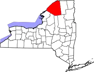 | |
| Towns | ||
| Villages | ||
| CDPs | ||
| Hamlets | ||
| Footnotes | ‡This populated place also has portions in an adjacent county or counties | |
This article is issued from Wikipedia. The text is licensed under Creative Commons - Attribution - Sharealike. Additional terms may apply for the media files.