Groveland Station, New York
Groveland Station is a census-designated place (CDP) in Livingston County, New York, United States. The CDP consists of the hamlet of Groveland[3] and nearby residential areas. The CDP population was 281 as of the 2010 census.[4] New York State Route 63 passes through the community.
Groveland Station, New York
Groveland | |
|---|---|
 Groveland Station  Groveland Station | |
| Coordinates: 42°39′48″N 77°46′00″W | |
| Country | United States |
| State | New York |
| County | Livingston |
| Towns | Groveland, Sparta |
| Area | |
| • Total | 0.59 sq mi (1.52 km2) |
| • Land | 0.59 sq mi (1.52 km2) |
| • Water | 0.00 sq mi (0.00 km2) |
| Elevation | 633 ft (193 m) |
| Population (2020) | |
| • Total | 246 |
| • Density | 419.80/sq mi (161.98/km2) |
| Time zone | UTC-5 (Eastern (EST)) |
| • Summer (DST) | UTC-4 (EDT) |
| Area code | 585 |
| GNIS feature ID | 2584263[2] |
| FIPS code | 36-31022 |
History
The Sparta First Presbyterian Church at the junction of Groveland Scottsburg Road and Groveland Hill Road was added to the National Register of Historic Places in 2007.[5]
Geography
The Groveland Station CDP is in south-central Livingston County, primarily in the town of Groveland but extending south into the town of Sparta. State Route 63 leads north 10 miles (16 km) to Geneseo, the Livingston county seat, and south 8 miles (13 km) to Dansville. State Route 258 leads west from Groveland Station 2 miles (3 km) to State Route 36, less than a mile from Exit 6 on Interstate 390.
According to the U.S. Census Bureau, the CDP has an area of 0.59 square miles (1.5 km2), all land.[6] The western border of the CDP follows Canaseraga Creek, which flows northwest to the Genesee River.
References
- "ArcGIS REST Services Directory". United States Census Bureau. Retrieved September 20, 2022.
- "Groveland Station Census Designated Place". Geographic Names Information System. United States Geological Survey, United States Department of the Interior.
- "Groveland, New York". Geographic Names Information System. United States Geological Survey, United States Department of the Interior.
- "Total Population: 2010 Census DEC Summary File 1 (P1), Groveland Station CDP, New York". data.census.gov. U.S. Census Bureau. Retrieved June 18, 2020.
- "National Register Information System". National Register of Historic Places. National Park Service. March 13, 2009.
- "U.S. Gazetteer Files: 2019: Places: New York". U.S. Census Bureau Geography Division. Retrieved June 18, 2020.
- "Census of Population and Housing". Census.gov. Retrieved June 4, 2016.
Municipalities and communities of Livingston County, New York, United States | ||
|---|---|---|
| Towns | 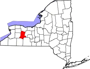 Map of New York highlighting Livingston County | |
| Villages | ||
| CDPs | ||
| Other hamlet | ||