Greenup, Illinois
Greenup is a village in Cumberland County, Illinois, United States, along the Embarras River. The population was 1,365 at the 2020 census.[3] It is part of the Charleston–Mattoon Micropolitan Statistical Area.
Greenup, Illinois | |
|---|---|
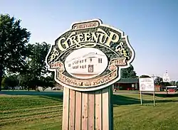
 "Village of the Porches" | |
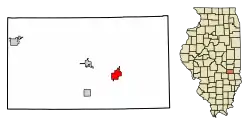
 Location of Greenup in Cumberland County, Illinois. | |
.svg.png.webp) Location of Illinois in the United States | |
| Coordinates: 39°14′54″N 88°09′35″W[1] | |
| Country | United States |
| State | Illinois |
| County | Cumberland |
| Township | Greenup |
| Area | |
| • Total | 1.75 sq mi (4.53 km2) |
| • Land | 1.75 sq mi (4.53 km2) |
| • Water | 0.00 sq mi (0.00 km2) |
| Elevation | 594 ft (181 m) |
| Population (2020) | |
| • Total | 1,365 |
| • Density | 780.00/sq mi (301.20/km2) |
| Time zone | UTC-6 (CST) |
| • Summer (DST) | UTC-5 (CDT) |
| ZIP Code | 62428 |
| Area code | 217 |
| FIPS code | 17-31524 |
| GNIS ID | 2398204[1] |
| Wikimedia Commons | Greenup, Illinois |
| Website | villageofgreenup |
Greenup received its name from National Road surveyor, William C. Greenup who platted the town in 1834. He was one of the supervisors hired to oversee construction of the National Road in Illinois, surveying the original alignment from Marshall to Vandalia during the 1830s. The village of Greenup served as the Cumberland County seat from 1843 to 1857.
History

Greenup was platted in 1834, and served as Cumberland County's first county seat from 1843 to 1855.[4]
Geography
Greenup is located southeast of the center of Cumberland County at 39°14′50″N 88°9′44″W (39.247273, -88.162131).[5] The Embarras River is a tributary of the Wabash River which runs past the northwest corner of the village. U.S. Route 40 runs through the village to the south of its center, while Interstate 70 runs through the northern corner of the village with access from Exit 119 (Illinois Route 130). Effingham is 22 miles (35 km) to the west, while Terre Haute, Indiana, is 44 miles (71 km) to the east.
According to the 2021 census gazetteer files, Greenup has a total area of 1.75 square miles (4.53 km2), of which 1.75 square miles (4.53 km2) (or 99.94%) is land and 0.00 square miles (0.00 km2) (or 0.06%) is water.[6]
Demographics
| Census | Pop. | Note | %± |
|---|---|---|---|
| 1870 | 535 | — | |
| 1880 | 605 | 13.1% | |
| 1890 | 858 | 41.8% | |
| 1900 | 1,085 | 26.5% | |
| 1910 | 1,224 | 12.8% | |
| 1920 | 1,230 | 0.5% | |
| 1930 | 1,062 | −13.7% | |
| 1940 | 1,410 | 32.8% | |
| 1950 | 1,360 | −3.5% | |
| 1960 | 1,477 | 8.6% | |
| 1970 | 1,618 | 9.5% | |
| 1980 | 1,655 | 2.3% | |
| 1990 | 1,616 | −2.4% | |
| 2000 | 1,532 | −5.2% | |
| 2010 | 1,513 | −1.2% | |
| 2020 | 1,365 | −9.8% | |
| U.S. Decennial Census[7] | |||
As of the 2020 census[3] there were 1,365 people, 735 households, and 381 families residing in the village. The population density was 779.55 inhabitants per square mile (300.99/km2). There were 701 housing units at an average density of 400.34 per square mile (154.57/km2). The racial makeup of the village was 93.26% White, 0.73% African American, 0.44% Native American, 0.22% Asian, 0.07% Pacific Islander, 0.37% from other races, and 4.91% from two or more races. Hispanic or Latino of any race were 1.54% of the population.
There were 735 households, out of which 30.9% had children under the age of 18 living with them, 44.49% were married couples living together, 4.90% had a female householder with no husband present, and 48.16% were non-families. 43.81% of all households were made up of individuals, and 26.80% had someone living alone who was 65 years of age or older. The average household size was 3.21 and the average family size was 2.33.
The village's age distribution consisted of 25.8% under the age of 18, 5.5% from 18 to 24, 26.4% from 25 to 44, 19.8% from 45 to 64, and 22.5% who were 65 years of age or older. The median age was 37.1 years. For every 100 females, there were 81.6 males. For every 100 females age 18 and over, there were 85.2 males.
The median income for a household in the village was $40,139, and the median income for a family was $72,598. Males had a median income of $47,143 versus $25,355 for females. The per capita income for the village was $22,561. About 7.1% of families and 14.8% of the population were below the poverty line, including 16.9% of those under age 18 and 9.9% of those age 65 or over.
Education
Students in Greenup attend Cumberland Community Unit School District 77. The elementary, middle, and high school are located in Toledo.
Notable people
- Lincoln Bancroft, Illinois state representative and mayor of Greenup.[8]
- Abe ("Ab") Bowman, pitcher for the Cleveland Indians, born in Greenup.
- James A. Peters, University of Michigan, herpetologist, Curator at Smithsonian Institution.[9]
- Bobbi Trout, pioneer aviator, born in Greenup.
- Cy Warman, 19th century author; born and raised near Greenup.
References
- U.S. Geological Survey Geographic Names Information System: Greenup, Illinois
- "2020 U.S. Gazetteer Files". United States Census Bureau. Retrieved March 15, 2022.
- "Explore Census Data". data.census.gov. Retrieved June 28, 2022.
- Edwards, Alice; Kummer, Karen (January 4, 1991). "National Register of Historic Places Registration Form - Greenup Commercial Historic District" (PDF). Illinois Historic Preservation Agency. Retrieved November 29, 2019.
- "US Gazetteer files: 2010, 2000, and 1990". United States Census Bureau. February 12, 2011. Retrieved April 23, 2011.
- Bureau, US Census. "Gazetteer Files". Census.gov. Retrieved June 29, 2022.
- "Census of Population and Housing". Census.gov. Retrieved June 4, 2015.
- 'Illinois Blue Book 1921-1922,' Biographical Sketch of Lincoln Bancroft, pg. 190
- "James Arthur Peters". fr.goldenmap.com. Archived from the original on December 12, 2013. Retrieved September 23, 2016.