Gerrard, Colorado
Gerrard is a census-designated place (CDP) in and governed by Rio Grande County, Colorado, United States. The population of the Gerrard CDP was 0 at the 2020 United States Census.[4] The South Fork post office (Zip Code 81154) serves the area.[3]
Gerrard, Colorado | |
|---|---|
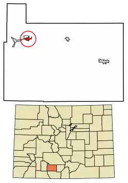 Location of the Gerrard CDP in Rio Grande County, Colorado. | |
 Gerrard Location of the Gerrard CDP in the United States. | |
| Coordinates: 37°40′42″N 106°34′31″W[1] | |
| Country | |
| State | |
| County | Rio Grande County |
| Government | |
| • Type | unincorporated community |
| Area | |
| • Total | 1.198 sq mi (3.103 km2) |
| • Land | 1.198 sq mi (3.103 km2) |
| • Water | 0.000 sq mi (0.000 km2) |
| Elevation | 8,123 ft (2,476 m) |
| Population (2020) | |
| • Total | 0 |
| • Density | 0/sq mi (0/km2) |
| Time zone | UTC-7 (MST) |
| • Summer (DST) | UTC-6 (MDT) |
| ZIP Code[3] | South Fork 81154 |
| Area code | 719 |
| GNIS feature[2] | Gerrard CDP |
Geography
The Gerrard CDP has an area of 767 acres (3.103 km2), all land.[1]
Demographics
| Year | Pop. | ±% |
|---|---|---|
| 2010 | 278 | — |
| 2020 | 264 | −5.0% |
| Source: United States Census Bureau | ||
The United States Census Bureau initially defined the Gerrard CDP for the United States Census 2010.
References
- "State of Colorado Census Designated Places - BAS20 - Data as of January 1, 2020". United States Census Bureau. Retrieved December 27, 2020.
- "U.S. Board on Geographic Names: Domestic Names". United States Geological Survey. Retrieved December 27, 2020.
- "Zip Code 81154 Map and Profile". zipdatamaps.com. 2020. Retrieved December 27, 2020.
- "2020: DEC Summary File 1". United States Census Bureau. Retrieved December 5, 2022.
External links
Wikimedia Commons has media related to Gerrard, Colorado.
Municipalities and communities of Rio Grande County, Colorado, United States | ||
|---|---|---|
| City | 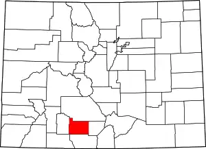 Map of Colorado highlighting Rio Grande County | |
| Towns | ||
| CDPs | ||
| Unincorporated community | ||
| Footnotes | ‡This populated place also has portions in an adjacent county or counties | |
This article is issued from Wikipedia. The text is licensed under Creative Commons - Attribution - Sharealike. Additional terms may apply for the media files.