Gauley River National Recreation Area
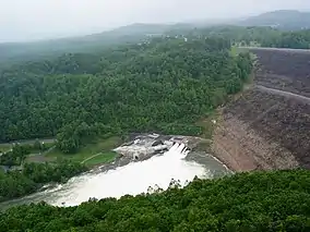
The Gauley River National Recreation Area, located near Summersville, West Virginia, protects a 25-mile (40 km) portion of the Gauley River and a 5.5-mile (8.9 km) segment of the Meadow River in southern West Virginia. Little of the national recreation area is accessible via roads; one must travel via the river. At the upstream end of the park is the Summersville Dam, the only area of the park accessible by vehicle.
| Gauley River National Recreation Area | |
|---|---|
IUCN category V (protected landscape/seascape)[1] | |
 | |
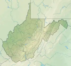 Location of Gauley River National Recreation Area in West Virginia  Gauley River National Recreation Area (the United States) | |
| Location | West Virginia, United States |
| Coordinates | 38°13′12″N 80°53′24″W |
| Area | 11,507 acres (46.57 km2) |
| Elevation | 1,375 ft (419 m)[2] |
| Established | 1988-10-26 |
| Visitors | 128796 |
| Operator | New River Gorge National River |
| Website | Gauley River National Recreation Area |
Rapids
Within the park are a number of Class V rapids. They have been given names such as:
- Insignificant
- Pillow Rock
- Lost Paddle
- Iron Ring
- Sweet's Falls
References
- "Gauley River National Recreation Area". Protected Planet. IUCN. Retrieved 30 April 2018.
- "Summersville Dam outlet". Elevation Query. U.S. Geological Survey. Retrieved 2009-01-31.
This article is issued from Wikipedia. The text is licensed under Creative Commons - Attribution - Sharealike. Additional terms may apply for the media files.