Gasteren
Gasteren is a village in the Dutch province of Drenthe. It is a part of the municipality of Aa en Hunze, and lies about 8 km east of Assen.
Gasteren | |
|---|---|
Village | |
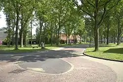 The village green of Gasteren | |
 Flag | |
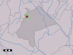 The village (dark red) and the statistical district (light green) of Gasteren in the municipality of Aa en Hunze. | |
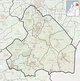 Gasteren Location in the Netherlands  Gasteren Gasteren (Netherlands) | |
| Coordinates: 53°2′10″N 6°39′48″E | |
| Country | Netherlands |
| Province | Drenthe |
| Municipality | Aa en Hunze |
| Area | |
| • Total | 9.14 km2 (3.53 sq mi) |
| Elevation | 10 m (30 ft) |
| Population (2021)[1] | |
| • Total | 400 |
| • Density | 44/km2 (110/sq mi) |
| Time zone | UTC+1 (CET) |
| • Summer (DST) | UTC+2 (CEST) |
| Postal code | 9466[1] |
| Dialing code | 0592 |
The village was first mentioned between 1298 and 1304 as "in villa Ghestre, apud Ghesteren". The etymology is unclear.[3]
The hunebed (dolmen) D11 is a small incomplete dolmen. It has been fenced off because there are sheep in the heath. It used to have four capstones, but only two have remained.[4] There are also 44 burial mounds around the village.[5]
Gasteren was home to 155 people in 1840.[5]
Gallery
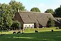 Farm in Gasteren
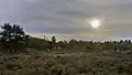 Gasterse Dunes
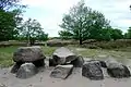 Dolmen D10 near Gasteren
References
- "Kerncijfers wijken en buurten 2021". Central Bureau of Statistics. Retrieved 10 April 2022.
- "Postcodetool for 9466PA". Actueel Hoogtebestand Nederland (in Dutch). Het Waterschapshuis. Retrieved 10 April 2022.
- "Gasteren - (geografische naam)". Etymologiebank (in Dutch). Retrieved 10 April 2022.
- "D10". Hunebedden (in Dutch). Retrieved 10 April 2022.
- "Gasteren". Plaatsengids (in Dutch). Retrieved 10 April 2022.
Wikimedia Commons has media related to Gasteren.
This article is issued from Wikipedia. The text is licensed under Creative Commons - Attribution - Sharealike. Additional terms may apply for the media files.