Gandzak, Armenia
Gandzak (Armenian: Գանձակ) is a village in the Gavar Municipality of the Gegharkunik Province of Armenia. The village is located on the eastern side of the Gavar river, 3 km southwest from the regional center Gavar, at an average height of 1,980 meters above sea level.
Gandzak
Գանձակ | |
|---|---|
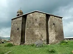 The 9th-century St. Gevorg Church in Gandzak | |
 Gandzak  Gandzak | |
| Coordinates: 40°19′28″N 45°06′54″E | |
| Country | Armenia |
| Province | Gegharkunik |
| Municipality | Gavar |
| Elevation | 1,978 m (6,490 ft) |
| Population | |
| • Total | 3,815 |
| Time zone | UTC+4 (AMT) |
| Postal code | 1206 |
| Gandzak, Armenia at GEOnet Names Server | |
Etymology
The village was previously known as Batikian and Batikyan, in honor of Batik Batikian (1892–1920), a Communist activist.
History
The village contains the 4th- or 5th-century half-ruined basilica of St. Astvatsatsin, and the domed 9th- or 10th-century St. Gevorg Church, in ancient times it had a domed hall. In the 19th century, Armenian migrants from Western Armenia covered the destroyed roofs with the logs.[2]
Gallery
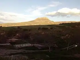 Scenery around Gandzak
.jpg.webp) Gandzak house of culture
Gandzak house of culture.jpg.webp) Gandzak municipality building
Gandzak municipality building.jpg.webp) Monument in Gandzak
Monument in Gandzak.jpg.webp) River in Gandzak
River in Gandzak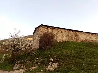 A church in Gandzak
References
- Statistical Committee of Armenia. "The results of the 2011 Population Census of Armenia" (PDF).
- Kiesling, Brady; Kojian, Raffi (2005). Rediscovering Armenia: Guide (2nd ed.). Yerevan: Matit Graphic Design Studio. p. 78. ISBN 99941-0-121-8.
External links
Wikimedia Commons has media related to Gandzak, Armenia.
- Report of the results of the 2001 Armenian Census, Statistical Committee of Armenia
- Kiesling, Brady (June 2000). Rediscovering Armenia: An Archaeological/Touristic Gazetteer and Map Set for the Historical Monuments of Armenia (PDF). Archived (PDF) from the original on 6 November 2021.

This article is issued from Wikipedia. The text is licensed under Creative Commons - Attribution - Sharealike. Additional terms may apply for the media files.