Gaanderen
Gaanderen is a village in the Dutch province of Gelderland. It is located in the municipality of Doetinchem. The number of inhabitants is around 5,575 (2020).[3]
Gaanderen | |
|---|---|
Village | |
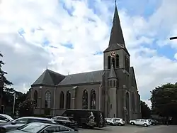 The church in Gaanderen | |
 Flag  Coat of arms | |
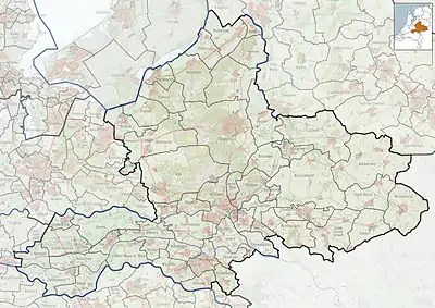 Gaanderen Location in the province of Gelderland in the Netherlands  Gaanderen Gaanderen (Netherlands) | |
| Coordinates: 51°55′41″N 6°20′41″E | |
| Country | Netherlands |
| Province | Gelderland |
| Municipality | Doetinchem |
| Area | |
| • Total | 9.15 km2 (3.53 sq mi) |
| Elevation | 15 m (49 ft) |
| Population (2021)[1] | |
| • Total | 5,575 |
| • Density | 610/km2 (1,600/sq mi) |
| Time zone | UTC+1 (CET) |
| • Summer (DST) | UTC+2 (CEST) |
| Postal code | 7011[1] |
| Dialing code | 0315 |
It was first mentioned around 1200 as de Gernere, and means "tapering land on a sandy ridge".[4]
Gaanderen was home to 482 people in 1840.[5] The St Martinus Church dates from 1913 and is a replacement of a 1854 church. The tower of the old church remained.[5]
Gallery
 Hoofdstraat 62, church
 Rekhemseweg 175
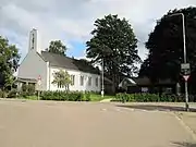
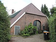 Kerkstraat 45
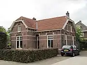 Bloemenweg 1
 Station Gaanderen
References
- "Kerncijfers wijken en buurten 2021". Central Bureau of Statistics. Retrieved 13 April 2022.
- "Postcodetool for 7011AA". Actueel Hoogtebestand Nederland (in Dutch). Het Waterschapshuis. Retrieved 13 April 2022.
- Kerncijfers Wijken en buurten_2020-1
- "Gaanderen - (geografische naam)". Etymologiebank (in Dutch). Retrieved 13 April 2022.
- "Gaanderen". Plaatsengids (in Dutch). Retrieved 13 April 2022.
Wikimedia Commons has media related to Gaanderen.
This article is issued from Wikipedia. The text is licensed under Creative Commons - Attribution - Sharealike. Additional terms may apply for the media files.