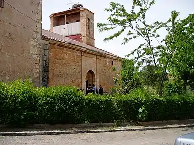
Fuentenebro
Fuentenebro is a municipality located in the province of Burgos, Castile and León, Spain. According to the 2015 census (INE), the municipality has a population of 139 inhabitants.
Fuentenebro | |
|---|---|
Municipality and town | |
 Seal | |
| Country | Spain |
| Autonomous community | |
| Province | |
| Comarca | Ribera del Duero |
| Area | |
| • Total | 39 km2 (15 sq mi) |
| Elevation | 911 m (2,989 ft) |
| Population (2018)[1] | |
| • Total | 126 |
| • Density | 3.2/km2 (8.4/sq mi) |
| Time zone | UTC+1 (CET) |
| • Summer (DST) | UTC+2 (CEST) |
| Postal code | 09461 |
| Website | http://www.fuentenebro.es/ |
Geography
It is a village located at the south of the Province of Burgos at 840 meters of altitude, it lies 100 km from the city of Burgos and 20 km from Aranda de Duero.
Its area is 38,92 km2 and its population is 139 inhabitants[2] (INE 2009) Its density is 3.57 inhabitants/km2.
Peñacuerno mountain (1,377 m)[3] is located in its municipality, being the southernmost point in the province.
Notes
- Municipal Register of Spain 2018. National Statistics Institute.
- "TablaPx". www.ine.es. Retrieved 2016-12-01.
- "EA1/SG-009, Peña Cuerno - 1377m, 6 Points". www.sota.org.uk. Retrieved 2016-12-01.
This article is issued from Wikipedia. The text is licensed under Creative Commons - Attribution - Sharealike. Additional terms may apply for the media files.
