List of airports in Antigua and Barbuda
There are three airports operating in Antigua and Barbuda, a nation lying between the Caribbean Sea and the Atlantic Ocean. Antigua and Barbuda consists of two major inhabited islands, Antigua and Barbuda, and a number of smaller islands (including Great Bird, Green, Guinea, Long, Maiden and York Islands). Separated by a few nautical miles, the group is in the middle of the Leeward Islands, part of the Lesser Antilles.
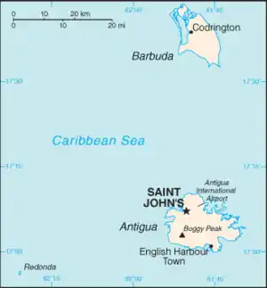
Map of Antigua and Barbuda
Airports
Boldface indicates the airport has scheduled passenger service on commercial airlines.
| City served | Island | ICAO | IATA | Airport name | Coordinates |
|---|---|---|---|---|---|
| St. John's | TAPA | ANU | V. C. Bird International Airport | 17°08′12″N 61°47′34″W | |
| Codrington | TAPH | BBQ | Barbuda Codrington Airport | 17°38′09″N 61°49′43″W | |
| Coco Point | TAPT | Coco Point Lodge Airstrip (private) | 17°33′20″N 61°45′55″W |
Heliports
| City served | City located | Island | ICAO | IATA | Airport name | Coordinates | Helipads | References |
|---|---|---|---|---|---|---|---|---|
| St. John's | St. John's | none | none | Fort Road Heliport | 17°08′04″N 61°51′26″W | 2 | [1] | |
| Jolly Harbour | Urlings | none | none | Orange Valley Heliport | 17°02′54″N 61°53′27″W | 1 | [2] |
See also
- Transport in Antigua and Barbuda
- List of airports by ICAO code: T#TA - Antigua and Barbuda
- Wikipedia: WikiProject Aviation/Airline destination lists: North America#Antigua and Barbuda
References
- https://www.google.com/maps/place/CalvinAir+Helicopters+-+Fort+Road+Heliport/@17.1343562,-61.8574982,110m/data=!3m1!1e3!4m5!3m4!1s0x8c12937c66bdc953:0x39e837075cf5566c!8m2!3d17.1345918!4d-61.8572172.
{{cite web}}: Missing or empty|title=(help) - https://www.google.com/maps/place/Calvin+Air+Orange+Valley/@17.0481468,-61.8932122,809m/data=!3m2!1e3!4b1!4m5!3m4!1s0x8c12f3d72dbb421d:0xf38debe4c8cc9201!8m2!3d17.0481726!4d-61.8910721.
{{cite web}}: Missing or empty|title=(help)
- "ICAO Location Indicators by State" (PDF). International Civil Aviation Organization. 17 September 2010.
- "UN Location Codes: Antigua and Barbuda". UN/LOCODE 2011-2. UNECE. 28 February 2012. – includes IATA codes
- Great Circle Mapper: Antigua and Barbuda – IATA codes, ICAO codes and coordinates
This article is issued from Wikipedia. The text is licensed under Creative Commons - Attribution - Sharealike. Additional terms may apply for the media files.