Flattnitz Pass
Flattnitz Pass (el. 1400 m.) is a high mountain pass in the Austrian Alps.
| Flattnitz Pass | |
|---|---|
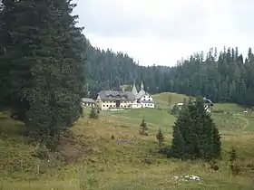 Panoramic view, with St John's Church | |
| Elevation | 1,400 m (4,593 ft) |
| Traversed by | L63 |
| Location | Carinthia, Austria |
| Range | Gurktal Alps |
| Coordinates | 46°56′31″N 14°2′7″E |
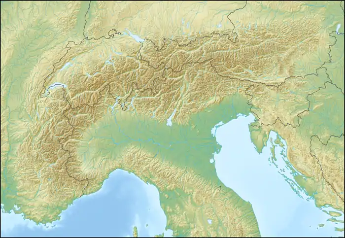 Flattnitz Pass Location of Flattnitz Pass | |
The pass is located in the state of Carinthia, connecting Glödnitz in the Gurk valley with Stadl on the Mur river, beyond the border with Styria. The pass height comprises a dispersed settlement with a high-altitude sanatorium (Luftkurort) and an Alpine lake (Flattnitzer See). It is a popular destination for hikers and for cross-country skiers in winter.
_18.jpg.webp)
The pass was possibly known in Roman times, it was first mentioned in an 898 deed issued by the Carolingian emperor Arnulf. In 1173 the Gurk bishops had a Romanesque chapel erected, dedicated to St John the Baptist, which was rebuilt as a parish church with an adjacent hospice building about 1330. The bishops used Flattnitz (from Slovene: blato, "moss") as a summer residence. The pass height was devastated by invading Ottoman forces in 1478. In the 17th century, Flattnitz was a mining area for silver, iron ore, and lead.
Climate
Flattnitz pass has a subarctic climate (Köppen Dfc) bordering on humid continental climate (Köppen Dfb).
| Climate data for Flattnitz Pass: 1437m (1991−2020 normals) | |||||||||||||
|---|---|---|---|---|---|---|---|---|---|---|---|---|---|
| Month | Jan | Feb | Mar | Apr | May | Jun | Jul | Aug | Sep | Oct | Nov | Dec | Year |
| Record high °C (°F) | 12.9 (55.2) |
14.3 (57.7) |
17.5 (63.5) |
20.7 (69.3) |
25.0 (77.0) |
28.8 (83.8) |
27.7 (81.9) |
29.5 (85.1) |
24.6 (76.3) |
19.1 (66.4) |
16.6 (61.9) |
14.2 (57.6) |
29.5 (85.1) |
| Average high °C (°F) | −0.2 (31.6) |
1.0 (33.8) |
4.0 (39.2) |
8.2 (46.8) |
12.7 (54.9) |
16.9 (62.4) |
17.6 (63.7) |
17.6 (63.7) |
13.4 (56.1) |
8.6 (47.5) |
3.8 (38.8) |
0.3 (32.5) |
8.7 (47.6) |
| Daily mean °C (°F) | −4.1 (24.6) |
−3.2 (26.2) |
−0.2 (31.6) |
3.4 (38.1) |
7.9 (46.2) |
11.7 (53.1) |
13.5 (56.3) |
13.1 (55.6) |
8.9 (48.0) |
4.8 (40.6) |
0.4 (32.7) |
−3.3 (26.1) |
4.4 (39.9) |
| Average low °C (°F) | −7.9 (17.8) |
−8.1 (17.4) |
−4.5 (23.9) |
−1.3 (29.7) |
2.7 (36.9) |
6.5 (43.7) |
7.7 (45.9) |
7.8 (46.0) |
4.4 (39.9) |
0.7 (33.3) |
−3.0 (26.6) |
−6.8 (19.8) |
−0.2 (31.7) |
| Record low °C (°F) | −22.6 (−8.7) |
−25.4 (−13.7) |
−22.4 (−8.3) |
−14.2 (6.4) |
−5.0 (23.0) |
−1.8 (28.8) |
−0.6 (30.9) |
−3.0 (26.6) |
−5.7 (21.7) |
−17.1 (1.2) |
−16.7 (1.9) |
−22.0 (−7.6) |
−25.4 (−13.7) |
| Average precipitation mm (inches) | 32.7 (1.29) |
35.8 (1.41) |
53.7 (2.11) |
78.4 (3.09) |
115.0 (4.53) |
151.6 (5.97) |
155.5 (6.12) |
171.2 (6.74) |
122.8 (4.83) |
112.7 (4.44) |
109.9 (4.33) |
56.0 (2.20) |
1,195.3 (47.06) |
| Source: Central Institute for Meteorology and Geodynamics[1] | |||||||||||||
References
- "Klimamittelwerte 1991-2020" (in German). Central Institute for Meteorology and Geodynamics. Retrieved 19 September 2023.
External links
| ||