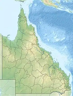
Evelyn, Queensland
Evelyn is a rural locality in the Tablelands Region, Queensland, Australia.[2] In the 2016 census, Evelyn had a population of 241 people.[1]
| Evelyn Queensland | |||||||||||||||
|---|---|---|---|---|---|---|---|---|---|---|---|---|---|---|---|
 Evelyn | |||||||||||||||
| Coordinates | 17.5097°S 145.4891°E | ||||||||||||||
| Population | 241 (2016 census)[1] | ||||||||||||||
| • Density | 3.066/km2 (7.941/sq mi) | ||||||||||||||
| Postcode(s) | 4888 | ||||||||||||||
| Area | 78.6 km2 (30.3 sq mi) | ||||||||||||||
| Time zone | AEST (UTC+10:00) | ||||||||||||||
| LGA(s) | Tablelands Region | ||||||||||||||
| State electorate(s) | Hill | ||||||||||||||
| Federal division(s) | Kennedy | ||||||||||||||
| |||||||||||||||
History
The name Evelyn is taken from the name of an early pastoral run, which was named by Francis Horace Stubley (a Member of the Queensland Legislative Assembly in the Electoral district of Kennedy 1878-83), after his wife.[3]
Evelyn Scrub Provisional School opened on 11 October 1895. On 1 January 1909, it became Evelyn Scrub State School. The school closed temporarily from 1918 to 1919. It closed permanently on 19 August 1946.[4]
Geraldton Road State School opened on 1916. It closed on 1960.[5] It was at 45 Geraldton Road (17.50658°S 145.50540°E).[6][7]
At the 2011 census, Evelyn recorded a population of 330.[8]
In the 2016 census, Evelyn had a population of 241 people.[1]
Geography
Longlands Gap–Herberton Road starts from the Kennedy Highway on the north-western boundary.[9]
Heritage listings
Evelyn has a number of heritage-listed sites, including:
- Jonsson Road: Evelyn Scrub War Memorial[10]
- off Jonsson Road: Cressbrook Cemetery[11]
See also
References
- Australian Bureau of Statistics (27 June 2017). "Evelyn (SSC)". 2016 Census QuickStats. Retrieved 20 October 2018.
- "Evelyn – locality in Tablelands Region (entry 48629)". Queensland Place Names. Queensland Government. Retrieved 29 December 2020.
- "Evelyn (entry 45810)". Queensland Place Names. Queensland Government. Retrieved 13 September 2015.
- Queensland Family History Society (2010), Queensland schools past and present (Version 1.01 ed.), Queensland Family History Society, ISBN 978-1-921171-26-0
- Queensland Family History Society (2010), Queensland schools past and present (Version 1.01 ed.), Queensland Family History Society, ISBN 978-1-921171-26-0
- "Queensland Two Mile series sheet 2m404" (Map). Queensland Government. 1953. Retrieved 10 April 2023.
- "Palmerston" (Map). Queensland Government. 1944. Retrieved 10 April 2023.
- Australian Bureau of Statistics (31 October 2012). "Evelyn (State Suburb)". 2011 Census QuickStats. Retrieved 14 July 2013.
- Google (27 July 2023). "Evelyn, Queensland" (Map). Google Maps. Google. Retrieved 27 July 2023.
- "Evelyn Scrub War Memorial (entry 602138)". Queensland Heritage Register. Queensland Heritage Council. Retrieved 14 July 2013.
- "Cressbrook Cemetery (entry 601900)". Queensland Heritage Register. Queensland Heritage Council. Retrieved 14 July 2013.