Estherville Municipal Airport
Estherville Municipal Airport (IATA: EST, ICAO: KEST, FAA LID: EST) is a public general aviation airport located four miles (six kilometers) east of Estherville, Emmet County, Iowa, United States. It is owned by the City of Estherville.[1]
Estherville Municipal Airport | |||||||||||||||
|---|---|---|---|---|---|---|---|---|---|---|---|---|---|---|---|
| Summary | |||||||||||||||
| Airport type | Public | ||||||||||||||
| Owner | City of Estherville | ||||||||||||||
| Serves | Estherville, Iowa | ||||||||||||||
| Elevation AMSL | 1,318.8 ft / 402 m | ||||||||||||||
| Coordinates | 43°24′26.9″N 094°44′47″W | ||||||||||||||
| Map | |||||||||||||||
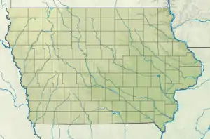
 EST Location of airport in Iowa/United States  EST EST (the United States) | |||||||||||||||
| Runways | |||||||||||||||
| |||||||||||||||
Facilities and aircraft
Estherville Municipal Airport covers an area of 400 acres (160 ha) which contains two runways: 16/34 with a concrete pavement measuring 4,797 by 75 ft (1,462 by 23 m) and 06/24 with a turf surface measuring 2,989 by 90 ft (911 by 27 m).[1] As of October 6, 2022, there were 18 aircraft based there, including 17 single-engine and one twin-engine. For the 12-month period ending September 4, 2020, there were an average of 24 aircraft operations per day, all of which were general aviation.[2] The airport hosts flight training for students of Iowa Lakes Community College's aviation program.[3]
See also
References
- FAA Airport Form 5010 for EST PDF, effective October 29, 2022
- http://www.airnav.com/airport/KEST (accessed October 29, 2022).
- http://inflightpilottraining.com/2021/04/history-of-iowa-lakes-community-college-aviation-programs/ (accessed October 29, 2022).
External links
- Resources for this airport:
- FAA airport information for EST
- AirNav airport information for KEST
- ASN accident history for EST
- FlightAware airport information and live flight tracker
- NOAA/NWS weather observations: current, past three days
- SkyVector aeronautical chart, Terminal Procedures