Elk Knob (Watauga County, North Carolina)
Elk Knob is a mountain in the North Carolina High Country, north of the community of Meat Camp. Its elevation reaches 5,538 feet (1,688 m).
| Elk Knob | |
|---|---|
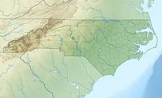 Elk Knob Location in North Carolina | |
| Highest point | |
| Elevation | 5,538 ft (1,688 m)[1] |
| Prominence | 1,000 feet (305 m)[2] |
| Coordinates | 36°19′38″N 81°40′36″W[1] |
| Geography | |
| Location | Watauga County, North Carolina, U.S. |
| Parent range | Blue Ridge Mountains |
| Topo map | USGS Zionville |
The mountain is the headwaters of the North Fork New River and feeder creeks to the South Fork New River (via Meat Camp Creek[3]). The mountain is home to Elk Knob State Park. Elk Knob is partially formed by amphibolites of the Ashe Metamorphic Suite and Alligator Back Metamorphic suite.[4]
References
- "Elk Knob". Geographic Names Information System. United States Geological Survey, United States Department of the Interior. Retrieved 2011-09-10.
- "Elk Knob - Peakbagger.com". Retrieved 2011-09-10.
- "Meat Camp Creek". Geographic Names Information System. United States Geological Survey, United States Department of the Interior. Retrieved 2011-09-10.
- "Geologic map of North Carolina". 2021-04-19. Archived from the original on 2018-10-06.
This article is issued from Wikipedia. The text is licensed under Creative Commons - Attribution - Sharealike. Additional terms may apply for the media files.