Dhungegadhi
Dhungegadhi is a town and Village Development Committee in Pyuthan, a Middle Hills district of Rapti Zone, western Nepal.
Dhungegadhi
ढुङ्गेगढी | |
|---|---|
Village Development Committee | |
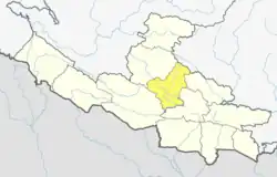
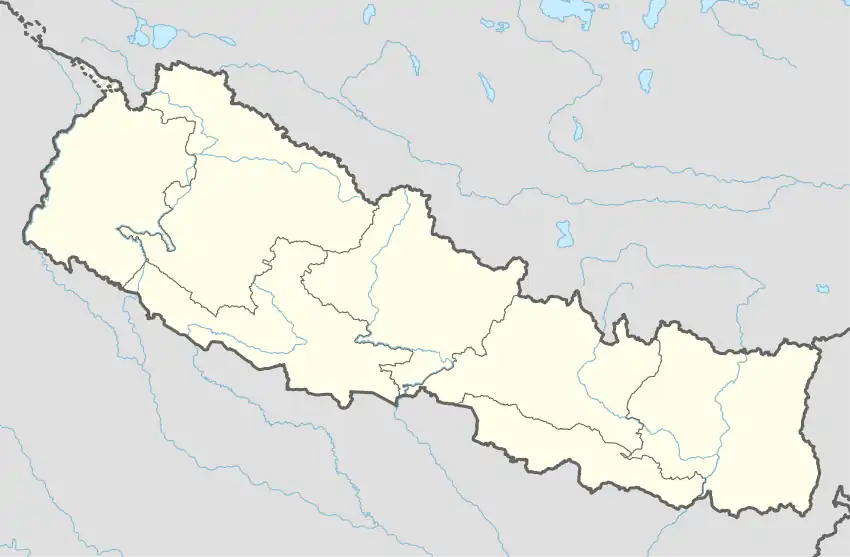 Dhungegadhi Location in Nepal | |
| Coordinates: 27.96°N 82.80°E | |
| Country | |
| Region | Mid-Western |
| Zone | Rapti Zone |
| District | Pyuthan District |
| VDC | Dhungegadhi |
| Population (2001 Census[1]) | |
| • Total | 3,180 |
| 479 households | |
| Time zone | UTC+5:45 (Nepal Time) |
Etymology
dhunge (Nepali: ढुङ्गे) - stony, made of stone
gadhi (Nepali: गढी) - tower, fortress
Thus: stone tower or fortress
Villages in VDC
| Ward | Lat. | Lon | Elev. | ||
|---|---|---|---|---|---|
| Baddanda | बडडाँडा | 3 | 27°58'N | 82°50'E | 892m |
| Bahundanda | बाहुनडाँडा | 27°56'N | 82°47'E | 790 | |
| Barapani | बरापानी | 27°57'N | 82°46'E | 950 | |
| Beldanda | बेलडाँडा | 27°57'N | 82°49'E | 750 | |
| Biringkot | बिरिङकोट | 27°56'N | 82°47'E | 1,030 | |
| Budhichaur | बुढीचौर | 27°58'N | 82°48'E | 1,270 | |
| Chhabise | छबिसे | 27°57'N | 82°49'E | 770 | |
| Dansingdanda | दानसिङडाँडा | 27°58'N | 82°49'E | 1,090 | |
| Dhankot | धनकोट | 27°58'N | 82°49'E | 1,270 | |
| Dhungegadhi | ढुङ्गेगढी | 8 | 27°57'N | 82°50'E | 938 |
| Dobichaur | दोबीचौर | 27°58'N | 82°46'E | 1,010 | |
| Ganaunepani | गनाउनेपानी | 27°57'N | 82°48'E | 770 | |
| Goldhara | गोलधारा | 27°58'N | 82°46'E | 1,150 | |
| Hattikhal | हात्तिखाल | 27°57'N | 82°46'E | 710 | |
| Jaspur | जसपुर | 27°57'N | 82°48'E | 970 | |
| Lugluge | लुग्लुगे | 27°56'N | 82°47'E | 730 | |
| Mandre | मान्द्रे | 27°59'N | 82°49'E | 970 | |
| Mandredhunga | मान्द्रेढुङ्गा | 27°59'N | 82°50'E | 710 | |
| Mitheamp | मिठेआँप | 27°57'N | 82°49'E | 490 | |
| Pakhapani | पाखापानी | 7 | 27°57'N | 82°47'E | 850 |
| Pelimati | पेलीमाटी | 27°58'N | 82°47'E | 1,310 | |
| Rangbhang | राङभाङ | 27°56'N | 82°48'E | 850 | |
| Shrikharka | श्रीखर्क | 27°58'N | 82°49'E | 1,050 | |
| Swarakot | स्वाराकोट | 27°58'N | 82°47'E | 1,322 | |
| Tarike | तारिके | 27°57'N | 82°47'E | 970 |
References
- "Nepal Census 2001". Nepal's Village Development Committees. Digital Himalaya. Archived from the original on 12 October 2008. Retrieved 21 September 2008.
- "Index of Geographical Names of Nepal, Volume IV: Mid Western Development Region, List of Settlements, Pyuthan" (PDF). Government of Nepal, National Geographic Information Infrastructure Program. Archived from the original (PDF) on 2011-07-24. Retrieved 2011-03-12.
External links
This article is issued from Wikipedia. The text is licensed under Creative Commons - Attribution - Sharealike. Additional terms may apply for the media files.