Cuyuni-Mazaruni
Cuyuni-Mazaruni (Region 7) is a region of Guyana. Venezuela claims the territory as part of Guayana Esequiba.
Cuyuni-Mazaruni
Region 7 | |
|---|---|
Administrative Region | |
 | |
 Flag | |
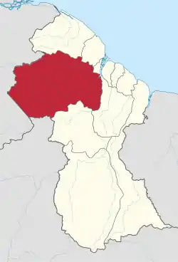 Map of Guyana showing Cuyuni-Mazaruni region | |
| Country | Claimed by |
| Regional Capital | Bartica |
| Area | |
| • Total | 47,213 km2 (18,229 sq mi) |
| Population (2012 census) | |
| • Total | 20,280 |
| • Density | 0.43/km2 (1.1/sq mi) |
| [2] | |
It borders the regions of Barima-Waini, Essequibo Islands-West Demerara and Pomeroon-Supenaam to the north, the region of Upper Demerara-Berbice to the east, the region of Potaro-Siparuni and Brazil to the south.
Its capital is Bartica, with villages including Issano, Kartabo, Kamarang, and Imbaimadai.
It covers an area of 47,213 km². Before the 1980 administrative reform most of the area belonged to the Mazaruni-Potaro district.[3]
Population
The Government of Guyana has administered three official censuses since the 1980 administrative reforms, in 1980, 1991 and 2002.[4] In 2012, the population of Cuyuni-Mazaruni was recorded at 20,280 people.[5] Official census records for the population of the Cuyuni-Mazaruni Region are as follows:
- 2012 : 20,280
- 2002 : 17,597
- 1991 : 14,794
- 1980 : 14,390
Communities
(including name variants):[6]
Gallery
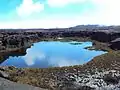 Gladys Lake
.jpg.webp) Bartica
Bartica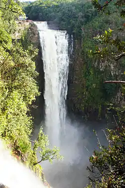 Kamarang Great falls
 Fort Kai-Kover-All
- Vulture Resort
See also
References
- "Official Announcements". Archived from the original on 8 September 2016. Retrieved 28 July 2016.
- Macmillan Publishers (2009). "Administrative Regions - 1 and 7". Macmillan Junior Atlas: Guyana. Oxford: Macmillan Caribbean. p. 36. ISBN 9780333934173.
- "Guyana Regions". Statoids. Retrieved 19 August 2020.
- Beaie, Sonkarley Tiatun (19 September 2007). "Chapter 3: National Redistribution and Internal Migration" (PDF). 2002 Population and Housing Census - Guyana National Report. Bureau of Statistics. p. 51. Archived from the original (PDF) on 17 February 2012. Retrieved 29 August 2012.
- Beaie, Sonkarley Tiatun (19 September 2007). "National Population Trends: Size, Growth and Distribution" (PDF Download). 2002 Population and Housing Census - Guyana National Report. Bureau of Statistics. p. 25. Retrieved 29 August 2012.
- "2012 Population by Village". Statistics Guyana. Retrieved 8 December 2021.