Coton, Northamptonshire
Coton is a hamlet and former civil parish, now in the parish of Ravensthorpe, in the West Northamptonshire district, in the ceremonial county of Northamptonshire, England.[1][2] It is located between Guilsborough and Ravensthorpe. Coton Manor is a popular visitor attraction for its gardens and bluebell woods. In 1931 the parish had a population of 83.[3]
| Coton | |
|---|---|
 Coton Manor | |
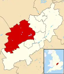
.svg.png.webp) Coton Location within Northamptonshire | |
| OS grid reference | SP6771 |
| Civil parish | |
| Unitary authority | |
| Ceremonial county | |
| Region | |
| Country | England |
| Sovereign state | United Kingdom |
| Post town | Northampton |
| Postcode district | NN6 |
| Dialling code | 01604 |
| Police | Northamptonshire |
| Fire | Northamptonshire |
| Ambulance | East Midlands |
| UK Parliament | |
History
The hamlet's name means 'At the cottages'.[4] In 1866 Coton became a civil parish, on 1 April 1935 the parish was abolished and merged with Ravensthorpe.[5]
References
- Ordnance Survey: Landranger map sheet 141 Kettering & Corby (Market Harborough & Stamford) (Map). Ordnance Survey. 2014. ISBN 9780319229866.
- "Ordnance Survey: 1:50,000 Scale Gazetteer" (csv (download)). www.ordnancesurvey.co.uk. Ordnance Survey. 1 January 2016. Retrieved 18 February 2016.
- "Population statistics Coton Hmlt/CP through time". A Vision of Britain through Time. Retrieved 27 March 2023.
- "Key to English Place-names". kepn.nottingham.ac.uk.
- "Relationships and changes Coton Hmlt/CP through time". A Vision of Britain through Time. Retrieved 27 March 2023.
External links
![]() Media related to Coton, Northamptonshire at Wikimedia Commons
Media related to Coton, Northamptonshire at Wikimedia Commons
- Map sources for Coton, Northamptonshire
- Coton Manor
This article is issued from Wikipedia. The text is licensed under Creative Commons - Attribution - Sharealike. Additional terms may apply for the media files.