Coinjock, North Carolina
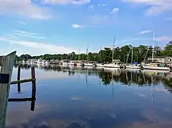
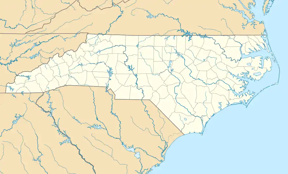
Coinjock is an unincorporated community and census-designated place (CDP) in Currituck County, North Carolina, United States. As of the 2010 census it had a population of 335.[3] It is located on U.S. Route 158 between Barco and Grandy, about 20 miles (32 km) south of the Virginia state line, and is at mile marker 50 on the southern portion of the Albemarle and Chesapeake Canal, on the Intracoastal Waterway. Church's Island to the east of Coinjock in the Currituck Sound has a village called Waterlily, which uses the postal address of Coinjock as well. The island's name is due to a decayed church that was once a landmark of the tiny community. Coinjock is bordered by Currituck Sound to the east; the North River lies to the west. Its ZIP Code is 27923.
Coinjock, North Carolina | |
|---|---|
 | |
 Coinjock | |
| Coordinates: 36°21′04″N 75°57′09″W | |
| Country | United States |
| State | North Carolina |
| County | Currituck |
| Area | |
| • Total | 0.87 sq mi (2.26 km2) |
| • Land | 0.84 sq mi (2.17 km2) |
| • Water | 0.03 sq mi (0.08 km2) |
| Elevation | 3 ft (0.9 m) |
| Population (2020) | |
| • Total | 337 |
| • Density | 401.19/sq mi (154.97/km2) |
| Time zone | UTC-5 (Eastern (EST)) |
| • Summer (DST) | UTC-4 (EDT) |
| ZIP Code | 27923 |
| Area code | 252 |
| GNIS feature ID | 2628619[2] |
| FIPS code | 37-13500 |
The name Coinjock is of Native American origin, meaning "the place of the blueberry swamps", referring to the swamp blueberries native to the county.[4][5] The name has also been spelled "Coenjock",[6] "Cowenjock",[7] or "Cornjack",[8] and sometimes as two words with the second beginning with a capital J. Bishop Thomas Coke visited Coenjock, as he called it, and preached to a small congregation in its chapel on March 19, 1785.[9]
The Coinjock Colored School was listed on the National Register of Historic Places in 2013.[10]
References
- "ArcGIS REST Services Directory". United States Census Bureau. Retrieved September 20, 2022.
- U.S. Geological Survey Geographic Names Information System: Coinjock, North Carolina
- "Geographic Identifiers: 2010 Demographic Profile Data (G001): Coinjock CDP, North Carolina". U.S. Census Bureau, American Factfinder. Archived from the original on February 12, 2020. Retrieved January 7, 2015.
- "Currituck Community Names". Retrieved July 6, 2019.
- Marston, Red (August 4, 1974). "Coinjock: Unpretentious reservoir for memories". St. Petersburg Times.
- Winter, R.F. (December 1, 2008). "Currituck County" (PDF). Postal history.
- "1850 Federal Census of Currituck County, North Carolina".
- Simpson, Bland (1997). Into the Sound Country. Ann Cary Bland. The University of North Carolina Press. p. 220. ISBN 0-8078-2381-3.
- Crowther, Jonathan (1815). The Life of the Rev. Thomas Coke, L.L.D. Leeds: E. Baines.
- "National Register of Historic Places Listings". Weekly List of Actions Taken on Properties: 1/07/13 through 1/11/13. National Park Service. January 18, 2013.
- "Census of Population and Housing". Census.gov. Retrieved June 4, 2016.
