Cohutta Wilderness
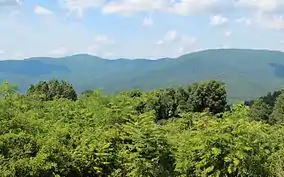
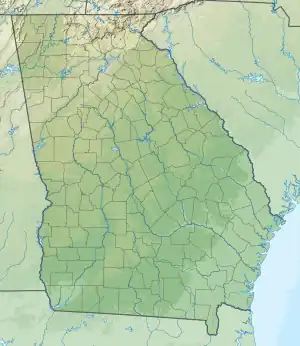
The Cohutta Wilderness was designated in 1975, expanded in 1986, and currently consists of 36,977 acres (149.64 km2). Approximately 35,268 acres (142.72 km2) are located in Georgia in the Chattahoochee National Forest and approximately 1,709 acres (6.92 km2) are located in Tennessee in the Cherokee National Forest. The Wilderness is managed by the United States Forest Service in Tennessee and is part of the National Wilderness Preservation System.

| Cohutta Wilderness | |
|---|---|
 | |
 | |
| Location | Fannin / Murray / Gilmer counties, Georgia / Polk County, Tennessee, USA |
| Nearest city | Crandall, Georgia |
| Coordinates | 34°52′32″N 84°37′32″W |
| Area | 36,977 acres (150 km2) |
| Established | 1975 |
| Governing body | U.S. Forest Service |
The Cohutta Wilderness is the largest wilderness in Georgia. With more than 60,000 visitors each year, it is also the largest, most heavily used wilderness in the Southern Appalachians.[1] In May, 2006, the Forest Service announced new limits on the use of the Wilderness, explaining:
"Overuse from visitors is causing resource impacts that are threatening the very qualities that made this area worthy of wilderness designation. Changes in the management of the Cohutta are necessary to reverse this trend to preserve the wilderness environment and provide future generations with the enjoyment of a true wilderness experience".[2]
Among the new regulations will be limits on the number of people allowed in a single group and on the use of camp fires.
The headwaters of the Conasauga River are located within the Wilderness, where the river starts as small cold stream from a spring at around 3,600 feet (1,100 m) and flows north toward Tennessee. The Benton MacKaye Trail traverses the Wilderness. The Cohutta Wilderness borders the Big Frog Wilderness which is also located in Georgia and Tennessee. The name Cohutta is derived from the Cherokee word cohutta, which means "frog" or could mean "a shed roof supported on poles".[3]
Rough Ridge fire

The Rough Ridge wildfire began on October 16, 2016 with a lightning strike. Due to drought conditions the wildfire rapidly expanded to 27,870 acres. The fire management objectives were to allow the fire to burn naturally and provide for firefighter and public safety.[4]
References
- "Excerpt from "Why Wilderness," published by The Wilderness Society". Archived from the original on 2006-05-14. Retrieved 2006-08-29.
- May 12, 2006 Forest Service Press Release
- Georgia Place Names by Kenneth K. Krakow, 3rd Edition (accessed November 2, 2006)
- "Wildfires Abound in U.S. Southern States". National Aeronautics and Space Administration. November 10, 2016. Archived from the original on 2016-11-14.