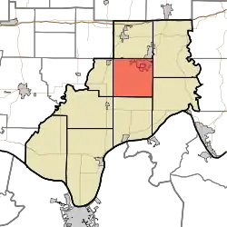
Clay Township, Spencer County, Indiana
Clay Township is one of nine townships in Spencer County, Indiana. As of the 2010 census, its population was 2,801 and it contained 1,185 housing units.[3]
Clay Township | |
|---|---|
 | |
| Coordinates: 38°04′25″N 86°57′16″W | |
| Country | United States |
| State | Indiana |
| County | Spencer |
| Government | |
| • Type | Indiana township |
| Area | |
| • Total | 37.24 sq mi (96.5 km2) |
| • Land | 36.39 sq mi (94.2 km2) |
| • Water | 0.85 sq mi (2.2 km2) |
| Elevation | 449 ft (137 m) |
| Population (2010) | |
| • Total | 2,801 |
| • Density | 77/sq mi (30/km2) |
| FIPS code | 18-13240[2] |
| GNIS feature ID | 453219 |
History
Clay Township was the last township of Spencer County to be organized, because the rolling hills and relatively poor soil attracted fewer settlers than other areas in the vicinity.[4]
Geography
According to the 2010 census, the township has a total area of 37.24 square miles (96.5 km2), of which 36.39 square miles (94.2 km2) (or 97.72%) is land and 0.85 square miles (2.2 km2) (or 2.28%) is water.[3]
Cities and towns
Places of interest
Lincoln Boyhood National Memorial lies within the township boundaries.
References
- "US Board on Geographic Names". United States Geological Survey. October 25, 2007. Retrieved January 31, 2008.
- "U.S. Census website". United States Census Bureau. Retrieved January 31, 2008.
- "Population, Housing Units, Area, and Density: 2010 - County -- County Subdivision and Place -- 2010 Census Summary File 1". United States Census. Archived from the original on February 12, 2020. Retrieved May 10, 2013.
- History of Warrick, Spencer, and Perry Counties, Indiana: From the Earliest Time to the Present. Goodspeed. 1885. p. 274.
External links
Municipalities and communities of Spencer County, Indiana, United States | ||
|---|---|---|
| City | Map of Indiana highlighting Spencer County | |
| Towns | ||
| Townships | ||
| CDPs | ||
| Other communities | ||
This article is issued from Wikipedia. The text is licensed under Creative Commons - Attribution - Sharealike. Additional terms may apply for the media files.