Cigeľ
Cigeľ (Hungarian: Cégely) is a village and municipality in Prievidza District in the Trenčín Region of western Slovakia.
Cigeľ | |
|---|---|
Village | |
 | |
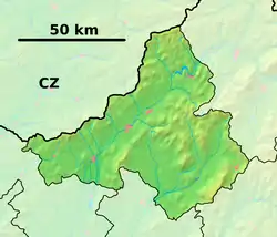 Cigeľ Location of Cigeľ in the Trenčín Region 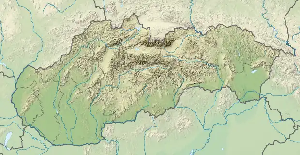 Cigeľ Location of Cigeľ in Slovakia | |
| Coordinates: 48°43′N 18°39′E | |
| Country | |
| Region | Trenčín |
| District | Prievidza |
| First mentioned | 1362 |
| Area | |
| • Total | 17.34[1] km2 (6.70[1] sq mi) |
| Elevation | 450[2] m (1,480[2] ft) |
| Population (2021) | |
| • Total | 1,267[3] |
| Postal code | 971 01[2] |
| Area code | +421 46[2] |
| Car plate | PD |
| Website | www.cigel.sk |
History
In historical records the village was first mentioned in 1362.
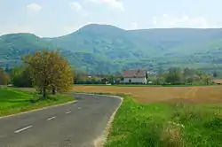
Geography
The municipality lies at an altitude of 460 metres and covers an area of 17.35 km². It has a population of about 1,036 people.
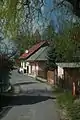
Gallery


Genealogical resources
The records for genealogical research are available at the state archive "Statny Archiv in Nitra, Slovakia"
- Roman Catholic church records (births/marriages/deaths): 1660-1895 (parish B)
References
- "Hustota obyvateľstva - obce [om7014rr_ukaz: Rozloha (Štvorcový meter)]". www.statistics.sk (in Slovak). Statistical Office of the Slovak Republic. 2022-03-31. Retrieved 2022-03-31.
- "Základná charakteristika". www.statistics.sk (in Slovak). Statistical Office of the Slovak Republic. 2015-04-17. Retrieved 2022-03-31.
- "Počet obyvateľov podľa pohlavia - obce (ročne)". www.statistics.sk (in Slovak). Statistical Office of the Slovak Republic. 2022-03-31. Retrieved 2022-03-31.
External links
![]() Media related to Cigeľ at Wikimedia Commons
Media related to Cigeľ at Wikimedia Commons
This article is issued from Wikipedia. The text is licensed under Creative Commons - Attribution - Sharealike. Additional terms may apply for the media files.