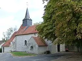
Châtillon-sur-Cher
Châtillon-sur-Cher (French pronunciation: [ʃatijɔ̃ syʁ ʃɛʁ]) is a commune in the Loir-et-Cher department in central France.[3] It has a total area of 29.66 km sq (11.45 sq mi).
Châtillon-sur-Cher | |
|---|---|
 | |
 Coat of arms | |
Location of Châtillon-sur-Cher | |
 Châtillon-sur-Cher  Châtillon-sur-Cher | |
| Coordinates: 47°16′40″N 1°29′41″E | |
| Country | France |
| Region | Centre-Val de Loire |
| Department | Loir-et-Cher |
| Arrondissement | Romorantin-Lanthenay |
| Canton | Saint-Aignan |
| Government | |
| • Mayor (2020–2026) | Alain Poma[1] |
| Area 1 | 29.66 km2 (11.45 sq mi) |
| Population | 1,679 |
| • Density | 57/km2 (150/sq mi) |
| Time zone | UTC+01:00 (CET) |
| • Summer (DST) | UTC+02:00 (CEST) |
| INSEE/Postal code | 41043 /41130 |
| Elevation | 67–118 m (220–387 ft) (avg. 93 m or 305 ft) |
| 1 French Land Register data, which excludes lakes, ponds, glaciers > 1 km2 (0.386 sq mi or 247 acres) and river estuaries. | |
Population
Châtillon-sur-Cher has a population of 1691 with a population density of 57/km sq according to 2019 census.
|
|
References
- "Répertoire national des élus: les maires". data.gouv.fr, Plateforme ouverte des données publiques françaises (in French). 2 December 2020.
- "Populations légales 2020". The National Institute of Statistics and Economic Studies. 29 December 2022.
- INSEE commune file
Wikimedia Commons has media related to Châtillon-sur-Cher.
This article is issued from Wikipedia. The text is licensed under Creative Commons - Attribution - Sharealike. Additional terms may apply for the media files.