Cerro de la Viga
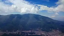
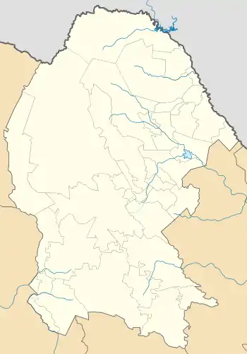
The Cerro de la Viga is a mountain located in the municipalities of Arteaga, Coahuila and Santiago, Nuevo León in northeastern Mexico. Its peak named Cerro San Rafael culminates at 3,712 m above the sea level and has a prominence of 1,395 m. It is the highest point in Coahuila and the second highest point in the Sierra Madre Oriental and in northern Mexico.[1][2] The mountain is surrounded by the Cerro Rancho Nuevo, Sierra El Álamo, Sierra San Isidro, Sierra Mauricio, Sierra El Muerto (Santiago), El Coahuilón, Sierra Las Alazanas and Cerro La Mina.
| Cerro de la Viga | |
|---|---|
| Sierra de la Viga Cerro San Rafael | |
 Cerro de la Viga seen from the Cerro Rancho Nuevo | |
| Highest point | |
| Elevation | 3,712 m (12,178 ft) |
| Prominence | 1,395 m (4,577 ft) |
| Coordinates | 25.3637°N 100.5571°W |
| Geography | |
 Cerro de la Viga | |
| Parent range | Sierra Madre Oriental |
Its 40-km-long ridge is the border between Coahuila and Nuevo León over 22 km.
In June 2011, a fire affected the southern side of the mountain.[3]
See also
References
- "Cerro San Rafael". peakbagger.com. November 1, 2004. Retrieved December 30, 2018.
- "Cerro San Rafael". bivouac.com. Retrieved December 30, 2018.
- "Incontrolable el incendio". El Diario de Coahuila (in Spanish). Archived from the original on April 11, 2019. Retrieved April 11, 2019.
This article is issued from Wikipedia. The text is licensed under Creative Commons - Attribution - Sharealike. Additional terms may apply for the media files.