Cazères
Cazères (French pronunciation: [kazɛʁ]; Occitan: Casèras), or sometimes locally called as Cazères-sur-Garonne, is a small town and commune in the Haute-Garonne department in southwestern France. Cazères station has rail connections to Toulouse, Pau and Tarbes. It is the seat (capital) of the canton of Cazères.
Cazères
| |
|---|---|
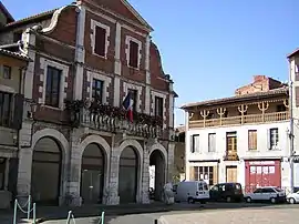 Town hall | |
.svg.png.webp) Coat of arms | |
Location of Cazères | |
 Cazères  Cazères | |
| Coordinates: 43°12′26″N 1°05′12″E | |
| Country | France |
| Region | Occitania |
| Department | Haute-Garonne |
| Arrondissement | Muret |
| Canton | Cazères |
| Government | |
| • Mayor (2021–2026) | Jean-Luc Riviere[1] |
| Area 1 | 19.55 km2 (7.55 sq mi) |
| Population | 4,753 |
| • Density | 240/km2 (630/sq mi) |
| Time zone | UTC+01:00 (CET) |
| • Summer (DST) | UTC+02:00 (CEST) |
| INSEE/Postal code | 31135 /31220 |
| Elevation | 215–362 m (705–1,188 ft) (avg. 240 m or 790 ft) |
| 1 French Land Register data, which excludes lakes, ponds, glaciers > 1 km2 (0.386 sq mi or 247 acres) and river estuaries. | |
The 2010 Census recorded the town having a population of 4,667 distributed between 1,290 households, decreasing to a population of 4,799 in 1,357 households in the 2019 Census.
Geography
The town lies on the banks of the Garonne river, which is forming a border with Gensac-sur-Garonne, Saint-Christaud, and Couladère.
The commune is bordered by nine other communes: Lavelanet-de-Comminges to the north, Le Fousseret to the northwest, Saint-Julien-sur-Garonne to the northeast, Gensac-sur-Garonne to the east, Saint-Christaud across the river Garonne to the southeast, Couladère across the river Garonne to the south, Palaminy and Saint-Michel to the southwest, and finally by Mondavezan to the east.
Population
The inhabitants of Cazères are known as Cazérien(ne)s in French.
| Year | Pop. | ±% p.a. |
|---|---|---|
| 1968 | 3,405 | — |
| 1975 | 3,419 | +0.06% |
| 1982 | 3,294 | −0.53% |
| 1990 | 3,155 | −0.54% |
| 1999 | 3,260 | +0.36% |
| 2007 | 4,129 | +3.00% |
| 2012 | 4,883 | +3.41% |
| 2017 | 4,889 | +0.02% |
| 2019 | 4,799 | −0.92% |
| Source: INSEE[3] | ||
References
- "Répertoire national des élus: les maires" (in French). data.gouv.fr, Plateforme ouverte des données publiques françaises. 4 May 2022.
- "Populations légales 2020". The National Institute of Statistics and Economic Studies. 29 December 2022.
- Population en historique depuis 1968, INSEE
External links