Caol
Caol (Gaelic: An Caol[2]) is a village near Fort William, in the Highland council area of Scotland. It is about 1+1⁄4 miles (2 kilometres) north of Fort William town centre, on the shore of Loch Linnhe, and is within the parish of Kilmallie.
Caol
| |
|---|---|
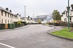 Kilmallie Road | |
 Caol Location within the Lochaber area | |
| Population | 3,310 (mid-2020 est.)[1] |
| OS grid reference | NN108762 |
| Council area | |
| Country | Scotland |
| Sovereign state | United Kingdom |
| Post town | FORT WILLIAM |
| Postcode district | PH33 |
| Dialling code | 01397 |
| Police | Scotland |
| Fire | Scottish |
| Ambulance | Scottish |
| UK Parliament | |
| Scottish Parliament | |
The name "Caol" is from the Gaelic for "narrow", in this case the narrow water between Loch Linnhe and Loch Eil.
The Caledonian Canal passes by to the north-west of Caol, and the Great Glen Way long-distance footpath passes through the village before it follows the canal towpath.
The village is largely residential, and has three primary schools, Caol Primary School; St Columba's RC Primary School; and, for Scottish Gaelic-medium education, the Bun-sgoil Ghàidhlig Loch Abar,[3] which has hosted the Lochaber Mòd since 2016.
The local shinty team is Kilmallie Shinty Club, which plays at Canal Park in the west of Caol.
References
- "Mid-2020 Population Estimates for Settlements and Localities in Scotland". National Records of Scotland. 31 March 2022. Retrieved 31 March 2022.
- "Place name database - Caol". Ainmean-Àite na h-Alba. Retrieved 14 November 2016.
- "Schools: Caol Primary School". Highland Council. Retrieved 14 March 2016.