Canta Province
Canta Province is a province in the Lima Region of Peru, situated approximately 105 kilometres (65 mi) to the northeast of the Peruvian capital, Lima.[1]
Canta | |
|---|---|
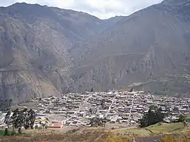 The town of Canta | |
 Flag  Coat of arms | |
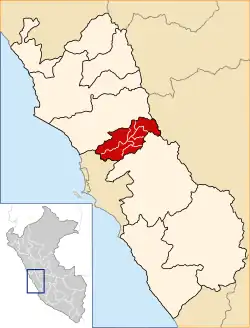 Location of Canta in the Lima Region | |
| Country | Peru |
| Region | Lima |
| Capital | Canta |
| Government | |
| • Mayor | Arturo Óscar Paredes Salcedo (2019-2022) |
| Area | |
| • Total | 1,687.29 km2 (651.47 sq mi) |
| Elevation | 2,819 m (9,249 ft) |
| Population | |
| • Total | 11,548 |
| • Density | 6.8/km2 (18/sq mi) |
| UBIGEO | 1504 |
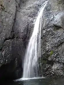
Velo de novia, Canta
Geography
One of the highest peaks of the province is Chunta at 5,208 m (17,087 ft). Other mountains are listed below:[2]
- Anta Mantay
- Anta Phiruru
- Aqu Mach'ay
- Awkichani
- Chakra Kancha
- Chakra Mit'u
- Ch'akiqucha
- Luk'ana
- Misk'i Pukyu
- Parqa Rumi
- Pistaq Mach'ay
- Pukara
- Qullpa P'iti
- Raqray
- Saywa
- Silla Rumi
- Tarapu
- Tunshu Marka
- Tuqtu Pallanka
- Waqutu
- Wayllas
- Wira Qaqa
- Yana Markan
- Yana Punta
- Yanama
Political division
The province is divided into seven districts.
- Arahuay (Arahuay)
- Canta (Canta)
- Huamantanga (Huamantanga)
- Huaros (Huaros)
- Lachaqui (Lachaqui)
- San Buenaventura (San Buenaventura)
- Santa Rosa de Quives (Yangas)
Sources and notes
- (in Spanish) Instituto Nacional de Estadística e Informática. Banco de Información Distrital Archived April 23, 2008, at the Wayback Machine. Retrieved April 11, 2008.
- escale.minedu.gob.pe/ UGEL map Canta Province (Lima Region)
This article is issued from Wikipedia. The text is licensed under Creative Commons - Attribution - Sharealike. Additional terms may apply for the media files.