Calamba, Misamis Occidental
Calamba, officially the Municipality of Calamba (Cebuano: Lungsod sa Calamba; Tagalog: Bayan ng Calamba), is a 4th class municipality in the province of Misamis Occidental, Philippines. According to the 2020 census, it has a population of 23,227 people.[3]
Calamba
Solinog | |
|---|---|
| Municipality of Calamba | |
 Flag  Seal | |
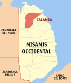 Map of Misamis Occidental with Calamba highlighted | |
OpenStreetMap | |
.svg.png.webp) Calamba Location within the Philippines | |
| Coordinates: 8°33′30″N 123°38′30″E | |
| Country | Philippines |
| Region | Northern Mindanao |
| Province | Misamis Occidental |
| District | 1st district |
| Founded | February 14, 1948 |
| Named for | Calamba, Laguna |
| Barangays | 19 (see Barangays) |
| Government | |
| • Type | Sangguniang Bayan |
| • Mayor | Luisito "Jun-Jun" B. Villanueva Jr. (PDPLBN) |
| • Vice Mayor | Antonio N. Lawas Sr. (NP) |
| • Representative | Jason P. Almonte (PDPLBN) |
| • Municipal Council | Members |
| • Electorate | 15,957 voters (2022) |
| Area | |
| • Total | 104.64 km2 (40.40 sq mi) |
| Highest elevation | 240 m (790 ft) |
| Lowest elevation | 11 m (36 ft) |
| Population (2020 census)[3] | |
| • Total | 23,227 |
| • Density | 220/km2 (570/sq mi) |
| • Households | 5,729 |
| Economy | |
| • Income class | 4th municipal income class |
| • Poverty incidence | 24.01 |
| • Revenue | ₱ 128.6 million (2020) |
| • Assets | ₱ 419.4 million (2020) |
| • Expenditure | ₱ 115.6 million (2020) |
| • Liabilities | ₱ 224.7 million (2020) |
| Service provider | |
| • Electricity | Misamis Occidental 1 Electric Cooperative (MOELCI 1) |
| Time zone | UTC+8 (PST) |
| ZIP code | 7210 |
| PSGC | |
| IDD : area code | +63 (0)88 |
| Native languages | Subanon Cebuano Tagalog |
| Website | www |
History
The municipality's name was originally called “Solinog”, which refers to a deep creek located at the eastern portion of the poblacion where Langaran River flows. Its name was later changed to Calamba by the Municipal Council of Plaridel, after the birthplace of a patriot Jose Rizal in Laguna in Luzon, where also some migrant Christian settlers in the municipality came from. It was formerly part of the municipal territory of Plaridel, Misamis Occidental. Being the fastest growing barrio, it was separated from the Municipality of Plaridel and became independent on February 1, 1948, under Executive Order No. 85 series of 1947 by President Manuel A. Roxas. It was inaugurated into a municipality thirteen days later, on Valentine's Day.
The Subanons were the original inhabitants of the municipality. They had the practice of clearing certain areas one after the other. Those cleared areas were later abandoned and were easily acquired by the new settlers coming from the Luzon, Visayas and other parts of Mindanao.
Geography
Barangays
Calamba is politically subdivided into 19 barangays. Each barangay consists of puroks while some have sitios.
- Bonifacio
- Bunawan
- Calaran
- Dapacan Alto
- Dapacan Bajo
- Langub
- Libertad
- Magcamiguing
- Mamalad
- Mauswagon
- Northern Poblacion
- Salvador
- San Isidro
- Siloy
- Singalat
- Solinog
- Southwestern Poblacion
- Sulipat
- Don Bernardo A. Neri
Climate
| Climate data for Calamba, Misamis Occidental | |||||||||||||
|---|---|---|---|---|---|---|---|---|---|---|---|---|---|
| Month | Jan | Feb | Mar | Apr | May | Jun | Jul | Aug | Sep | Oct | Nov | Dec | Year |
| Average high °C (°F) | 27 (81) |
27 (81) |
29 (84) |
30 (86) |
30 (86) |
29 (84) |
29 (84) |
29 (84) |
30 (86) |
29 (84) |
29 (84) |
28 (82) |
29 (84) |
| Average low °C (°F) | 22 (72) |
22 (72) |
22 (72) |
23 (73) |
24 (75) |
24 (75) |
23 (73) |
23 (73) |
23 (73) |
23 (73) |
23 (73) |
22 (72) |
23 (73) |
| Average precipitation mm (inches) | 69 (2.7) |
44 (1.7) |
37 (1.5) |
29 (1.1) |
87 (3.4) |
137 (5.4) |
131 (5.2) |
141 (5.6) |
143 (5.6) |
134 (5.3) |
68 (2.7) |
53 (2.1) |
1,073 (42.3) |
| Average rainy days | 9.9 | 7.6 | 7.4 | 8.1 | 21.6 | 26.5 | 26.4 | 26.6 | 25.8 | 24.3 | 15.1 | 10.4 | 209.7 |
| Source: Meteoblue (Use with caution: this is modeled/calculated data, not measured locally.)[5] | |||||||||||||
Demographics
|
| ||||||||||||||||||||||||||||||||||||||||||
| Source: Philippine Statistics Authority[6][7][8][9] | |||||||||||||||||||||||||||||||||||||||||||
In the 2020 census, the population of Calamba, Misamis Occidental, was 23,227 people,[3] with a density of 220 inhabitants per square kilometre or 570 inhabitants per square mile.
Education

- Calamba Central School
- Calamba National Comprehensive High School
- Liberation Institute
- Sacred Heart College of Calamba, Inc.(SHCCI)
- College of Communication, Information & Technology (CCIT)
References
- Municipality of Calamba | (DILG)
- "2015 Census of Population, Report No. 3 – Population, Land Area, and Population Density" (PDF). Philippine Statistics Authority. Quezon City, Philippines. August 2016. ISSN 0117-1453. Archived (PDF) from the original on May 25, 2021. Retrieved July 16, 2021.
- Census of Population (2020). "Region X (Northern Mindanao)". Total Population by Province, City, Municipality and Barangay. Philippine Statistics Authority. Retrieved July 8, 2021.
- "PSA Releases the 2018 Municipal and City Level Poverty Estimates". Philippine Statistics Authority. December 15, 2021. Retrieved January 22, 2022.
- "Calamba: Average Temperatures and Rainfall". Meteoblue. Retrieved April 29, 2020.
- Census of Population (2015). "Region X (Northern Mindanao)". Total Population by Province, City, Municipality and Barangay. Philippine Statistics Authority. Retrieved June 20, 2016.
- Census of Population and Housing (2010). "Region X (Northern Mindanao)". Total Population by Province, City, Municipality and Barangay. National Statistics Office. Retrieved June 29, 2016.
- Censuses of Population (1903–2007). "Region X (Northern Mindanao)". Table 1. Population Enumerated in Various Censuses by Province/Highly Urbanized City: 1903 to 2007. National Statistics Office.
- "Province of Misamis Occidental". Municipality Population Data. Local Water Utilities Administration Research Division. Retrieved December 17, 2016.
External links
- Philippine Standard Geographic Code
- Philippine Census Information
- Local Governance Performance Management System
Places adjacent to Calamba, Misamis Occidental | ||||||||||||||||
|---|---|---|---|---|---|---|---|---|---|---|---|---|---|---|---|---|
| ||||||||||||||||
| Municipalities | |
|---|---|
| Component cities | |