Burrows, Indiana
Burrows is an unincorporated community in Liberty Township, Carroll County, Indiana, United States. It is part of the Lafayette, Indiana Metropolitan Statistical Area.
Burrows | |
|---|---|
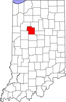 Carroll County's location in Indiana | |
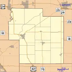 Burrows Location in Carroll County | |
| Coordinates: 40°40′36″N 86°30′27″W | |
| Country | United States |
| State | Indiana |
| County | Carroll |
| Township | Liberty |
| Area | |
| • Total | 0.39 sq mi (1.01 km2) |
| • Land | 0.39 sq mi (1.01 km2) |
| • Water | 0.00 sq mi (0.00 km2) |
| Elevation | 699 ft (213 m) |
| Population (2020) | |
| • Total | 125 |
| • Density | 319.69/sq mi (123.31/km2) |
| Time zone | UTC-5 (EST) |
| • Summer (DST) | UTC-4 (EST) |
| ZIP code | 46916 |
| Area code | 574 |
| FIPS code | 18-09460[2] |
| GNIS feature ID | 431874[3] |
History
The Burrows post office was originally called Cornucopia.[4] The post office opened at Burrows (Cornucopia) in 1853.[5]
Geography
Burrows is located at 40°40′36″N 86°30′27″W. Indiana State Road 25 and the Norfolk Southern Railway both pass northeast through town.
References
- "2020 U.S. Gazetteer Files". United States Census Bureau. Retrieved March 16, 2022.
- "U.S. Census website". United States Census Bureau. Retrieved January 31, 2008.
- "Burrows, Indiana". Geographic Names Information System. United States Geological Survey, United States Department of the Interior. Retrieved October 10, 2009.
- Baker, Ronald L. (October 1995). From Needmore to Prosperity: Hoosier Place Names in Folklore and History. Indiana University Press. p. 83. ISBN 978-0-253-32866-3.
A post office called Cornucopia was established here...
- "Carroll County". Jim Forte Postal History. Retrieved August 28, 2014.
- "Census of Population and Housing". Census.gov. Retrieved June 4, 2016.
Municipalities and communities of Carroll County, Indiana, United States | ||
|---|---|---|
| City | Map of Indiana highlighting Carroll County | |
| Towns | ||
| Townships | ||
| CDPs | ||
| Other communities | ||
This article is issued from Wikipedia. The text is licensed under Creative Commons - Attribution - Sharealike. Additional terms may apply for the media files.