Brownsville, South Carolina
Brownsville is a populated place in Marlboro County, South Carolina, United States.
Brownsville, South Carolina | |
|---|---|
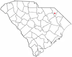 Location of Brownsville, South Carolina | |
| Coordinates: 34.392°N 79.592°W | |
| Country | United States |
| State | South Carolina |
| County | Marlboro |
| Elevation | 135 ft (41 m) |
| Time zone | UTC-5 (Eastern (EST)) |
| • Summer (DST) | UTC-4 (EDT) |
| ZIP code | 29516 |
| Area code(s) | 843, 854 |
| GNIS feature ID | 1221028 |
Geography
Brownsville is located at latitude 34.392 and longitude -79.592. The elevation is 135 feet.[1]
Demographics
References
- "Brownsville Populated Place Profile". SC Hometown Locator. Retrieved October 23, 2014.
External links
Municipalities and communities of Marlboro County, South Carolina, United States | ||
|---|---|---|
| City | 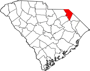 Map of South Carolina highlighting Marlboro County | |
| Towns | ||
| CDP | ||
| Unincorporated communities | ||
This article is issued from Wikipedia. The text is licensed under Creative Commons - Attribution - Sharealike. Additional terms may apply for the media files.