Breedeweg
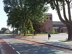
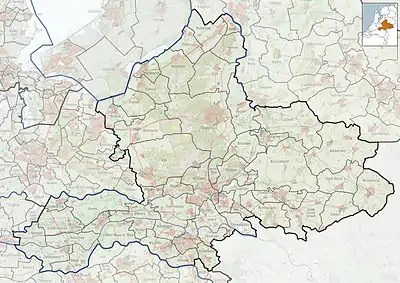
Breedeweg is a village in the Dutch province of Gelderland. It is located in the municipality of Berg en Dal, about 1 km south of Groesbeek.[3]
Breedeweg | |
|---|---|
 St. Antonius church | |
 Breedeweg Location in the province of Gelderland  Breedeweg Breedeweg (Netherlands) | |
| Coordinates: 51.7578°N 5.9402°E | |
| Country | Netherlands |
| Province | Gelderland |
| Municipality | Berg en Dal |
| Area | |
| • Total | 5.45 km2 (2.10 sq mi) |
| Elevation | 37 m (121 ft) |
| Population (2021)[1] | |
| • Total | 2,570 |
| • Density | 470/km2 (1,200/sq mi) |
| Time zone | UTC+1 (CET) |
| • Summer (DST) | UTC+2 (CEST) |
| Postal code | 6562[1] |
| Dialing code | 024 |
It was first mentioned in 1899 as Breedeweg, and means "wide road".[4] The St. Antonius Church was built in 1934, and destroyed in 1944 during Operation Market Garden. In 1949, the church was rebuilt, and a monument has been erected for the dead allied soldiers and the two civilians who were killed by a grenade while cleaning up the debris.[5]
Breedeweg and Groesbeek have been expanding, and are now close to one-another. In the late 2010s, the municipality changed the place name sign to "Groesbeek Breedeweg". Nevertheless, it is still a separate village and not annexed.[5]
Gallery
_Bredeweg%252C_pastorie_St.Antoniusweg_2_(01).JPG.webp) Former clergy house
Former clergy house_Bredeweg%252C_Kruksebaan_26.JPG.webp) Farm in Breedeweg
Farm in Breedeweg_Breedeweg_oorlogsmonument_Pegasus_(02).JPG.webp) War memorial Pegasus
War memorial Pegasus
References
- "Kerncijfers wijken en buurten 2021". Central Bureau of Statistics. Retrieved 20 March 2022.
- "Postcodetool for 6562AA". Actueel Hoogtebestand Nederland (in Dutch). Het Waterschapshuis. Retrieved 20 March 2022.
- ANWB Topografische Atlas Nederland, Topografische Dienst and ANWB, 2005.
- "Breedeweg - (geografische naam)". Etymologiebank (in Dutch). Retrieved 20 March 2022.
- "Breedeweg". Plaatsengids (in Dutch). Retrieved 20 March 2022.
Wikimedia Commons has media related to Breedeweg.
This article is issued from Wikipedia. The text is licensed under Creative Commons - Attribution - Sharealike. Additional terms may apply for the media files.