Bowser, British Columbia
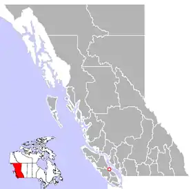
Bowser (/ˈbaʊzər/ BOUGH-zər)[1] is a community on the east coast of Vancouver Island in British Columbia, Canada. It has a population of 1,729. Approximately 66 kilometres (41 mi) north of Nanaimo, Bowser is in a region informally known as Lighthouse Country, spanning a stretch of highway that extends from Qualicum Beach in the south to Horne Lake to the west and Fanny Bay in the north and east to Denman and Hornby Islands. Bowser is in the Regional District of Nanaimo and in its Electoral Area H, one of eight in the District.[2] The community was named after William J. Bowser, premier of British Columbia from 1915 to 1916.[3]
Bowser's local hotel was famous in the 1930s for a dog trained by his owners to deliver beer bottles to tables, receive the payment, and deliver change,[4] a feat listed in "Ripley's Believe It or Not!".
Bowser has lent its name to a soil series which is widespread on eastern Vancouver Island. Bowser loamy sand is mapped under the whole community.[5]
Bowser is served by the coast-spanning Island Highway.
References
- The Canadian Press Stylebook (18th ed.), Toronto: The Canadian Press, The Canadian Press, 2017
- "Electoral Areas". Rdn.bc.ca. 2011-11-15. Archived from the original on 2014-02-02. Retrieved 2014-06-03.
- "Bowser". BC Geographical Names.
- Hagemoen, Christine (November 26, 2019). "You Should Know About "Mike" the Bartender". Islandist. Archived from the original on June 17, 2020. Retrieved August 20, 2021.
- Day, J.H.; Farstad, L.; Laird, D.G. (1959). "Soil Survey of Southeast Vancouver Island and Gulf Islands, British Columbia". Government of Canada. Archived from the original on 2013-05-22. Retrieved August 20, 2021.
Sources
- "Bowser." Encyclopedia of British Columbia. 2000
- "Bowser, British Columbia, Canada". Britishcolumbia.com. Archived from the original on March 21, 2006. Retrieved August 20, 2021.