Boulcott
Boulcott is a central suburb of Lower Hutt City situated in the south of the North Island of New Zealand. The suburb lies about a kilometre north-east of the Lower Hutt CBD.
Boulcott | |
|---|---|
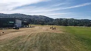
 Boulcott's Farm Heritage Golf Club makes up a large area of the Boulcott suburb. | |
| Coordinates: 41.203616°S 174.921551°E | |
| Country | New Zealand |
| City | Lower Hutt City |
| Local authority | Hutt City Council |
| Electoral ward | Central |
| Area | |
| • Land | 158 ha (390 acres) |
| Population (June 2022)[2] | |
| • Total | 2,760 |
| Hospital(s) | Hutt Hospital, Boulcott Hospital |
| Belmont | Avalon | |
| Tirohanga |
|
Epuni |
| Lower Hutt CBD |
Boulcott takes its name from Almon Boulcott (1815-1880), who farmed in the area in the 1840s.[3] His father, John Ellerker Boulcott (1784-1855), was a director of the New Zealand Company.[4] Armed conflict took place in the area at Boulcott's Farm in 1846 during the Hutt Valley Campaign.
Two Lower Hutt hospitals; Hutt Hospital and Boulcott Hospital, lie in Boulcott.
Demographics
Boulcott statistical area covers 1.58 km2 (0.61 sq mi).[1] It had an estimated population of 2,760 as of June 2022,[2] with a population density of 1,747 people per km2.
| Year | Pop. | ±% p.a. |
|---|---|---|
| 2006 | 2,451 | — |
| 2013 | 2,487 | +0.21% |
| 2018 | 2,613 | +0.99% |
| Source: [5] | ||
Boulcott had a population of 2,613 at the 2018 New Zealand census, an increase of 126 people (5.1%) since the 2013 census, and an increase of 162 people (6.6%) since the 2006 census. There were 936 households, comprising 1,236 males and 1,377 females, giving a sex ratio of 0.9 males per female. The median age was 40.6 years (compared with 37.4 years nationally), with 447 people (17.1%) aged under 15 years, 471 (18.0%) aged 15 to 29, 1,245 (47.6%) aged 30 to 64, and 453 (17.3%) aged 65 or older.
Ethnicities were 71.8% European/Pākehā, 8.8% Māori, 5.5% Pasifika, 21.8% Asian, and 2.3% other ethnicities. People may identify with more than one ethnicity.
The percentage of people born overseas was 27.2, compared with 27.1% nationally.
Although some people chose not to answer the census's question about religious affiliation, 44.1% had no religion, 41.7% were Christian, 0.2% had Māori religious beliefs, 4.8% were Hindu, 0.9% were Muslim, 1.4% were Buddhist and 1.4% had other religions.
Of those at least 15 years old, 639 (29.5%) people had a bachelor's or higher degree, and 324 (15.0%) people had no formal qualifications. The median income was $36,800, compared with $31,800 nationally. 522 people (24.1%) earned over $70,000 compared to 17.2% nationally. The employment status of those at least 15 was that 1,101 (50.8%) people were employed full-time, 300 (13.9%) were part-time, and 96 (4.4%) were unemployed.[5]
Education
Boulcott has two schools:
- Boulcott School, a state contributing primary (Year 1–6) school. It has 315 students as of April 2023.[6]
- St Oran's College, a state-integrated Presbyterian girls' Year 7–13 secondary school. It has 511 students as of April 2023.[6]
The nearest state intermediate (Year 7 and 8) schools are Naenae Intermediate School in Avalon to the north-east or Hutt Intermediate School in Woburn to the south. The nearest state secondary (Year 9–13) school is Naenae College in Avalon.
References
- "ArcGIS Web Application". statsnz.maps.arcgis.com. Retrieved 10 June 2021.
- "Population estimate tables - NZ.Stat". Statistics New Zealand. Retrieved 25 October 2022.
- Te Ara: The Encyclopaedia of New Zealand - Hutt Valley - central and west Retrieved: 10 January 2009
- Louis E. Ward (1928), Early Wellington, Auckland, Whitcombe and Toombs
- "Statistical area 1 dataset for 2018 Census". Statistics New Zealand. March 2020. Boulcott (244200). 2018 Census place summary: Boulcott
- "New Zealand Schools Directory". New Zealand Ministry of Education. Retrieved 12 December 2022.