Besalampy
Besalampy is a rural municipality on the west coast of Madagascar. It belongs to the district of Besalampy, which is a part of Melaky Region. The population of the municipality was 11331 in 2018.
Besalampy | |
|---|---|
 Besalampy Location in Madagascar | |
| Coordinates: 16°45′S 44°29′E | |
| Country | |
| Region | Melaky |
| District | Besalampy |
| Elevation | 30 m (100 ft) |
| Population (2018)Census | |
| • Total | 11,331 |
| Time zone | UTC3 (EAT) |
| Postal code | 410 |
Besalampy is served by a local Besalampy Airport and maritime harbour. In addition to primary schooling the town offers secondary education at both junior and senior levels. The town has a permanent court and hospital.[2]
The majority 65% of the population of the municipality are farmers, while an additional 30% receives their livelihood from raising livestock. Most important export product is raffia palms.[3] Other important crops are bananas, seeds of catechu and oranges. Additionally fishing employs 5% of the population.[2] There is also a prawn farm in Besalampy.
History
In 2008 the municipality was destroyed by 95% by the Cyclone Fame[4]
Roads
Bemarivo is crossed by the unpaved National road 19T.
Climate
| Climate data for Besalampy (1991–2020) | |||||||||||||
|---|---|---|---|---|---|---|---|---|---|---|---|---|---|
| Month | Jan | Feb | Mar | Apr | May | Jun | Jul | Aug | Sep | Oct | Nov | Dec | Year |
| Record high °C (°F) | 35.3 (95.5) |
35.4 (95.7) |
36.2 (97.2) |
35.8 (96.4) |
35.5 (95.9) |
33.9 (93.0) |
33.7 (92.7) |
35.6 (96.1) |
36.0 (96.8) |
37.5 (99.5) |
38.7 (101.7) |
37.0 (98.6) |
38.7 (101.7) |
| Average high °C (°F) | 30.3 (86.5) |
30.5 (86.9) |
31.3 (88.3) |
31.5 (88.7) |
30.7 (87.3) |
29.7 (85.5) |
29.1 (84.4) |
29.7 (85.5) |
30.8 (87.4) |
31.5 (88.7) |
31.8 (89.2) |
31.3 (88.3) |
30.7 (87.3) |
| Daily mean °C (°F) | 27.4 (81.3) |
27.4 (81.3) |
27.9 (82.2) |
27.7 (81.9) |
26.4 (79.5) |
24.9 (76.8) |
24.3 (75.7) |
24.9 (76.8) |
26.1 (79.0) |
27.2 (81.0) |
28.0 (82.4) |
27.9 (82.2) |
26.7 (80.1) |
| Average low °C (°F) | 24.4 (75.9) |
24.3 (75.7) |
24.4 (75.9) |
23.8 (74.8) |
22.0 (71.6) |
20.1 (68.2) |
19.4 (66.9) |
20.0 (68.0) |
21.3 (70.3) |
23.0 (73.4) |
24.1 (75.4) |
24.6 (76.3) |
22.6 (72.7) |
| Record low °C (°F) | 21.0 (69.8) |
20.4 (68.7) |
19.4 (66.9) |
17.3 (63.1) |
14.4 (57.9) |
13.6 (56.5) |
12.9 (55.2) |
13.7 (56.7) |
14.1 (57.4) |
16.5 (61.7) |
19.0 (66.2) |
20.2 (68.4) |
12.9 (55.2) |
| Average precipitation mm (inches) | 445.4 (17.54) |
319.9 (12.59) |
162.1 (6.38) |
33.2 (1.31) |
4.2 (0.17) |
4.5 (0.18) |
0.4 (0.02) |
2.7 (0.11) |
3.3 (0.13) |
10.9 (0.43) |
51.6 (2.03) |
186.1 (7.33) |
1,224.3 (48.20) |
| Average precipitation days (≥ 1.0 mm) | 17.3 | 14.9 | 11.5 | 3.4 | 0.4 | 0.3 | 0.1 | 0.4 | 0.7 | 1.1 | 4.5 | 10.5 | 65.1 |
| Source: NOAA[6] | |||||||||||||
See also
- Bemarivo Reserve at 12 km from Besalampy.
- the Maningoza Reserve is located in the district of Besalampy.
- Melaky
References
- Estimated based on DEM data from Shuttle Radar Topography Mission
- "ILO census data". Cornell University. 2002. Retrieved 2008-03-04.
- France agricole - Le raphia, perle rare de Madagascar
- Cyclone Fame
- Eaux et hydrographie
- "Besalampy Climate Normals 1991–2020". World Meteorological Organization Climatological Standard Normals (1991–2020). National Oceanic and Atmospheric Administration. Archived from the original on 25 September 2023. Retrieved 25 September 2023.
Capital: Maintirano | ||
| Antsalova (6) - 406 | 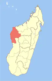 | |
| Ambatomainty (5) - 404 | ||
| Besalampy (9) - 410 |
| |
| Maintirano (16) - 413 | ||
| Morafenobe (4) - 416 | ||
5 districts; 40 communes | ||