Bath Locks
Bath Locks (grid reference ST756643) are a series of locks, now six locks, situated at the start of the Kennet and Avon Canal, at Bath, England.

Bath Bottom Lock, which is numbered as No 7 on the canal, is the meeting with the River Avon just south of Pulteney Bridge.[1] Alongside the lock is a side pond and pumping station which pumps water up the locks to replace that used each time the lock is opened.[2]
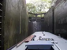
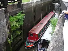
The next stage of Bath Deep Lock is numbered 8/9 as two locks were combined when the canal was restored in 1976. A road constructed while the canal was in a state of disrepair passes over the original site of the lower lock.[3] The new chamber has a depth of 5.92 metres (19 ft 5 in),[4] making it Britain's second deepest canal lock.[5]

Just above the 'deep lock' is an area of water enabling the lock to refill and above this is Wash House Lock (number 10),[6] and soon after by Abbey View Lock (number 11), a Grade II listed building[7] by which there is another pumping station and in quick succession Pulteney Lock (12) and Bath top Lock (13).[8]

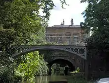
Above the top lock the canal passes through Sydney Gardens where it passes through two tunnels[9][10] and under two cast iron footbridges dating from 1800. Cleveland tunnel is 52.7 metres (173 ft) long and runs under Cleveland House, the former headquarters of the Kennet and Avon Canal Company. The tunnel is a Grade II* listed building.[11]
Many of the bridges over the canal are also listed buildings.[12][13][14][15][16][17]
The locks were restored in 1968 by a collaboration involving staff from British Waterways and volunteer labour organised by the Kennet and Avon Canal Trust.[18]
References
- "Bath Bottom Lock". Images of England. Archived from the original on 19 October 2012. Retrieved 4 September 2006.
- "former engine house". Images of England. Archived from the original on 21 October 2012. Retrieved 4 September 2006.
- "Second Lock". Images of England. Archived from the original on 16 November 2007. Retrieved 4 September 2006.
- "Bath Deep Lock". Canal and River Trust. Retrieved 30 December 2014.
- "Deepest Canal Locks in England". Pennine Waterways. Archived from the original on 12 October 2007. Retrieved 2 October 2007.
- "Wash House Lock". Images of England. Archived from the original on 13 October 2007. Retrieved 4 September 2006.
- "Abbey View Lock". Images of England. Archived from the original on 10 October 2007. Retrieved 4 September 2006.
- "Top Lock". Images of England. Archived from the original on 2 December 2007. Retrieved 4 September 2006.
- "Tunnel under Beckford Road". Images of England. Archived from the original on 27 November 2007. Retrieved 4 September 2006.
- "Tunnel under Cleveland House and Sydney Road". Images of England. Archived from the original on 13 October 2007. Retrieved 4 September 2006.
- "Cleveland House". Images of England. Archived from the original on 12 October 2012. Retrieved 4 September 2006.
- "Footbridge Adjoining Top Lock". Images of England. Archived from the original on 16 November 2007. Retrieved 4 September 2006.
- "Footbridge adjoining Wash House Lock". Images of England. Archived from the original on 18 November 2007. Retrieved 4 September 2006.
- "Footbridge over Canal". Images of England. Archived from the original on 14 October 2007. Retrieved 4 September 2006.
- "Canal Bridge". Images of England. Archived from the original on 22 October 2012. Retrieved 4 September 2006.
- "Bridge over Canal". Images of England. Archived from the original on 22 October 2012. Retrieved 4 September 2006.
- "Canal Bridge (Pulteney Gardens)". Images of England. Archived from the original on 22 November 2007. Retrieved 4 September 2006.
- "Kennet & Avon Canal". Inland Waterways Association. Retrieved 17 May 2011.