Bamu River
The Bamu River is a river in southwestern Papua New Guinea.[3][4]
| Bamu River Gwavi River, Aworra River | |
|---|---|
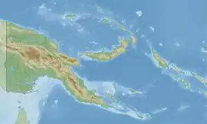 Location within Papua New Guinea | |
| Location | |
| Country | |
| Region | Western Province |
| Physical characteristics | |
| Source | |
| • location | Great Papuan Plateau, Southern Highlands Province |
| • coordinates | 6°38′51.666″S 142°49′12.432″E |
| • elevation | 1,113 m (3,652 ft) |
| Mouth | Gulf of Papua |
• location | Bamu Rural LLG |
• coordinates | 8°4′1.7796″S 143°42′37.2888″E |
• elevation | 0 m (0 ft) |
| Length | 310 km (190 mi)[1] |
| Basin size | 19,346.5 km2 (7,469.7 sq mi)[1] |
| Discharge | |
| • location | Near mouth |
| • average | (Period: 1971-2000)1,113.6 m3/s (39,330 cu ft/s)[1] to 2,000 m3/s (71,000 cu ft/s)(1986)[2] |
| Basin features | |
| Tributaries | |
| • right | Wawoi, Aramia |
See also
- List of rivers of Papua New Guinea
- Bamu language, a language of Papua New Guinea
- Bamu Rural LLG, Papua New Guinea
References
- "Papua New Guinea Coast".
- Rudy, Slingerland; Neal W., Driscoll; John D., Milliman; Scott R., Miller; Elizabeth A., Johnstone (2008). Anatomy and growth of a Holocene clinothem in the Gulf of Papua.
- Bamu River in Geonames.org (cc-by); post updated 2012-01-17; database downloaded 2015-06-22
- "HOTOSM Papua New Guinea Waterways (OpenStreetMap Export)". Humanitarian Data Exchange. 1.31.9. Retrieved 5 June 2019.
This article is issued from Wikipedia. The text is licensed under Creative Commons - Attribution - Sharealike. Additional terms may apply for the media files.