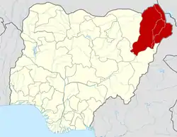
Bama, Nigeria
Bama is a local government area of Borno State, Nigeria. It has its headquarters in the town of Bama.
Bama, Nigeria | |
|---|---|
LGA and town | |
| Country | |
| State | Borno State |
| Time zone | UTC+1 (WAT) |
Landscape
It has an area of 4,997 km2.
Population
The population was recorded as 269,986 in the 2006 census.
Climate
Bama has a Subtropical steppe climate (Classification: BSh). The district’s yearly temperature is 31.88ºC (89.38ºF) and it is 2.42% higher than Nigeria’s averages. Bama typically receives about 36.06 millimeters (1.42 inches) of precipitation and has 61.03 rainy days (16.72% of the time) annually.[1]
Postal Code
The postal code of the area is 610.[2]
History
It is located "about 60 kilometres (37 miles) from Maiduguri, the capital of Borno state".[3]
It is one of the sixteen LGAs that constitute the Dikwa Emirate, a traditional state located in Borno State, Nigeria.[4]
Insurgency Cases
The town was attacked by Boko Haram in May 2013 and February 2014.[5][6] As of 22 June 2014,
The two border towns of Bama and Gwoza have been cut off since the declaration of a state of emergency with soldiers blocking the roads linking the town to the state capital, Maiduguri ... Escapees from Bama were forced to take bush routes through Dikwa, a town 60km away from Bama and 150km from Maiduguri to get to the state capital.[7]
On September 2, 2014, Boko Haram seized control of Bama, according to the town's residents.[8]
In December 2014, it was reported that "people too elderly to flee Gwoza Local Government Area were being rounded up and taken to two schools where the militants opened fire on them." Over 50 elderly people were killed.[9] A "gory video" was released of insurgents shooting over a hundred civilians in a school dormitory in the town of Bama.[10]
On 16 March 2015, the Nigerian army said that it had recaptured the city.[11]
On 22 June 2016, the NGO Medicins Sans Frontiers (MSF) reported a "catastrophic humanitarian emergency" in a camp for refugees fleeing Boko Haram near the town of Bama.[12][13] They stated that more than 1,200 people have died of starvation and illness at the camp.[14] They also reported that between 23 May 2016 and 22 June 2016, at least 188 people have died at the camp (almost six per day), mainly from malnutrition and diarrhoea.[12]
References
- "Bama, Borno, NG Climate Zone, Monthly Averages, Historical Weather Data". tcktcktck.org. Retrieved 2023-08-29.
- "Post Offices- with map of LGA". NIPOST. Archived from the original on 7 October 2009. Retrieved 2009-10-20.
- "Africa - Suspected Islamist rebels raid northeast Nigerian town". France 24. 2014-02-19. Archived from the original on 2014-06-30. Retrieved 2014-06-28.
- Nigeria (2000). Nigeria: a people united, a future assured. Vol. 2, State Surveys (Millennium ed.). Abuja, Nigeria: Federal Ministry of Information. p. 106. ISBN 9780104089.
- Ross, Will (2013-05-07). "Nigeria: 'Many dead in Boko Haram raid' in Borno state". BBC News. Retrieved 2014-06-28.
- Ross, Will (2014-02-19). "Nigeria's Boko Haram crisis: Bama attack mars victory claims". BBC News. Retrieved 2014-06-28.
- Ola' Audu. "Boko Haram sacks residents of Bama, Gwoza in Borno". Premium Times. Retrieved 2014-06-28.
- Nigeria's Boko Haram 'seize' Bama town in Borno
- "Nigeria: Boko Haram Kills More Than 50 Elderly People". This Day -- allAfrica.com. Retrieved 2015-01-08.
- Kareem Haruna (2014-12-22). "Nigeria: New Video Shows Boko Haram Shooting Civilians at School Dormitory". Leadership (Abuja) - allAfrica.com. Retrieved 2015-01-08.
- Julia Payne (2015-03-16). "Nigeria military says Bama city recaptured from Boko Haram". Reuters.
- "Nigeria: At least 24,000 displaced people in dire health situation in Bama". Retrieved 2016-06-24.
- "Nigeria Boko Haram: Scores of refugees starved to death - MSF". BBC News. Retrieved 2016-06-24.
- Lagos, Reuters in (2016-06-23). "More than 1,200 die of starvation and illness at Nigeria refugee camp". the Guardian. Retrieved 2016-06-24.
{{cite web}}:|first=has generic name (help)
