Baerami, New South Wales
Baerami is a locality in the Muswellbrook Shire in the Upper Hunter region of New South Wales, Australia.
| Baerami New South Wales | |||||||||||||||
|---|---|---|---|---|---|---|---|---|---|---|---|---|---|---|---|
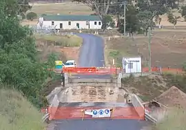
 Kirks Bridge and Baerami community hall | |||||||||||||||
 Baerami Location in New South Wales | |||||||||||||||
| Coordinates | 32°23′15″S 150°28′05″E | ||||||||||||||
| Population | 93 (SAL 2021)[1] | ||||||||||||||
| Postcode(s) | 2333 | ||||||||||||||
| Elevation | 165 m (541 ft)[2] | ||||||||||||||
| Time zone | AEST (UTC+10) | ||||||||||||||
| • Summer (DST) | AEDT (UTC+11) | ||||||||||||||
| Location | |||||||||||||||
| LGA(s) | Muswellbrook Shire | ||||||||||||||
| Region | Upper Hunter | ||||||||||||||
| County | Hunter | ||||||||||||||
| Parish | Baerami | ||||||||||||||
| State electorate(s) | Upper Hunter | ||||||||||||||
| Federal division(s) | Hunter | ||||||||||||||
| |||||||||||||||
The Bylong Valley Way crosses the Baerami Creek via Kirks Bridge at Baerami. Downstream of the bridge, the creek meets its confluence with the Goulburn River.[3]
The area now known as Baerami lies on the traditional lands of Wonnarua people.[4]
The name Baerami comes from a large landholding that was subdivided into smaller pieces of land in 1926.[5][6] The homestead 'Baerami House', built in 1875, still exists.[7] The origin of the word Baerami is likely a settler rendering of an Aboriginal said to mean 'a spear thrower'.[8]
The name of Baerami is associated with a deposit of oil shale, which was reputedly the largest in New South Wales and around twice the size of that at Glen Davis. However, the site where mining occurred lies on Baerami Creek, approximately 25 km south of the road junction that is near the crossing of Baerami Creek at Baerami,[9][10] in the adjacent locality of Baerami Creek.
The Sandy Hollow-Gulgong goods railway line passes through the locality.
Points of interest include Baerami Community Hall, James Estate, Dingo Gully, and the old Baerami Catholic Church.
See also
References
- Australian Bureau of Statistics (28 June 2022). "Baerami (Suburb and Locality)". Australian Census 2021 QuickStats. Retrieved 28 June 2022.
- "Map of Baerami, NSW". Bonzle Digital Atlas of Australia. Retrieved 15 October 2013.
- "Baerami Creek". Geographical Names Register (GNR) of NSW. Geographical Names Board of New South Wales. Retrieved 15 October 2013.
- Studies, Australian Institute of Aboriginal and Torres Strait Islander (10 November 2022). "Map of Indigenous Australia". aiatsis.gov.au. Retrieved 22 June 2023.
- "Advertising". Land. 10 September 1926. p. 18. Retrieved 22 June 2023.
- "Big Land Sale". Mudgee Guardian and North-Western Representative. 15 November 1926. p. 5. Retrieved 22 June 2023.
- "PRESS RELEASE: "Baerami House" | Baerami Creek / DenmanAustralian Rural Property News: Meares & Associates". www.meares.com.au. Retrieved 22 June 2023.
- "Hunter Valley Place Names - B". www.freesettlerorfelon.com. Retrieved 22 June 2023.
- "Muswellbrook Heritage Study - Inventory 1996 - Creek Shale Mine and Retorts" (PDF).
- "Explore with self drive tours - Sandy Hollow to Wollemi" (PDF). Upper Hunter Country Tourism.
| Preceding station | Former Services | Following station | ||
|---|---|---|---|---|
| Widden towards Gulgong |
Sany Hollow - Gulgong Line | Sandy Hollow Terminus | ||