Badami Bagh
Badami Bagh is a cantonment town on the outskirts of Srinagar city in Srinagar district in the Indian union territory of Jammu and Kashmir. A portion of Indian army in the valley resides in the Badami Bagh cantonment. Badami Bagh Cantonment is the headquarters of the Indian Army's 15 Corps.[3] The cantonment is established on the two road sides of Srinagar Jammu National Highway.
Badami Bagh | |
|---|---|
Town | |
 Badami Bagh Location in Jammu and Kashmir, India  Badami Bagh Badami Bagh (India) | |
| Coordinates: 34.07°N 74.85°E | |
| Country | |
| Union territory | Jammu and Kashmir |
| District | Srinagar |
| Elevation | 1,727 m (5,666 ft) |
| Population (2001) | |
| • Total | 13,477 |
| Languages | |
| • Official | Kashmiri, Dogri, Urdu, Hindi, English[1][2] |
| Time zone | UTC+5:30 (IST) |
Geography
Badami Bagh is located at 34.07°N 74.85°E.[4] It has an average elevation of 1727 metres (5666 feet).
Demographics
As of 2001 India census,[5] Badami Bagh had a population of 13,477. Males constitute 53% of the population and females 47%. Badami Bagh has an average literacy rate of 71%, higher than the national average of 59.5%; with 58% of the males and 42% of females literate. 6% of the population is under 6 years of age.
References
- "The Jammu and Kashmir Official Languages Act, 2020" (PDF). The Gazette of India. 27 September 2020. Retrieved 27 September 2020.
- "Parliament passes JK Official Languages Bill, 2020". Rising Kashmir. 23 September 2020. Archived from the original on 24 September 2020. Retrieved 23 September 2020.
- "Indian Army says encouraging to see overwhelming response to Swarnim Vijay Mashaal".
- Falling Rain Genomics, Inc - Badami Bagh
- "Census of India 2001: Data from the 2001 Census, including cities, villages and towns (Provisional)". Census Commission of India. Archived from the original on 16 June 2004. Retrieved 1 November 2008.
| Passes | 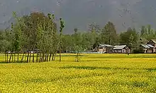 | |
|---|---|---|
| Valleys | ||
| Cities | ||
| Towns |
| |
| Rivers | ||
| Glaciers | ||
| Lakes | ||
| Mountains | ||
| Hill stations and Mughal gardens | ||
| Protected Areas | ||
| See also | ||