Baía de Santa Marta
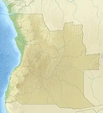
Baia de Santa Marta, also known as Baía das Luciras or Espiegle Bay, is a bay in Angola.[4] It is located in the Namibe Province.
| Baia de Santa Marta | |
|---|---|
 Baia de Santa Marta Location in Angola | |
| Coordinates | 13°51′S 12°29′E |
| Native name | Baía das Luciras (Portuguese) |
| Ocean/sea sources | Atlantic Ocean |
| Basin countries | Angola |
| Max. length | 2 km (1.2 mi) |
| Max. width | 4.5 km (2.8 mi) |
| Settlements | Lucira[1] |
| Cabo de Santa Marta Lighthouse | |
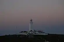 | |
| Coordinates | 13°52′42″S 12°25′23″E |
| Constructed | ~1930s |
| Foundation | masonry base |
| Construction | masonry tower |
| Height | 14 metres (46 ft)[2] |
| Shape | hexagonal tower with balcony and light |
| Markings | white tower |
| Operator | Instituto Marítimo e Portuário de Angola |
| Focal height | 48 metres (157 ft)[2] |
| Range | 12 nautical miles (22 km; 14 mi)[2] |
| Characteristic | Fl (2) W 6s.[2] |
| Angola no. | PT-5450[3] |
Geography
The Baia de Santa Marta is a bay of the Atlantic Ocean located in a small stretch of the Angolan coast where the shore turns sharply east for about 10 km and then north again. The bay is facing northwest and the small town of Lucira is located on its shores. The northern headland is Ponta da Bissonga and the eastern one Ponta Branca.[4]
References
- GoogleEarth
- List of Lights, Pub. 113: The West Coasts of Europe and Africa, the Mediterranean Sea, Black Sea and Azovskoye More (Sea of Azov) (PDF). List of Lights. United States National Geospatial-Intelligence Agency. 2015.
- Rowlett, Russ. "Lighthouses of Angola". The Lighthouse Directory. University of North Carolina at Chapel Hill. Retrieved 9 May 2017.
- "Baia de Santa Marta". Mapcarta. Retrieved 12 October 2016.
African seas | |
|---|---|
| Oceans and seas | |
| Gulfs and bays |
|
| Straits |
|
| Historical seas | |
This article is issued from Wikipedia. The text is licensed under Creative Commons - Attribution - Sharealike. Additional terms may apply for the media files.